

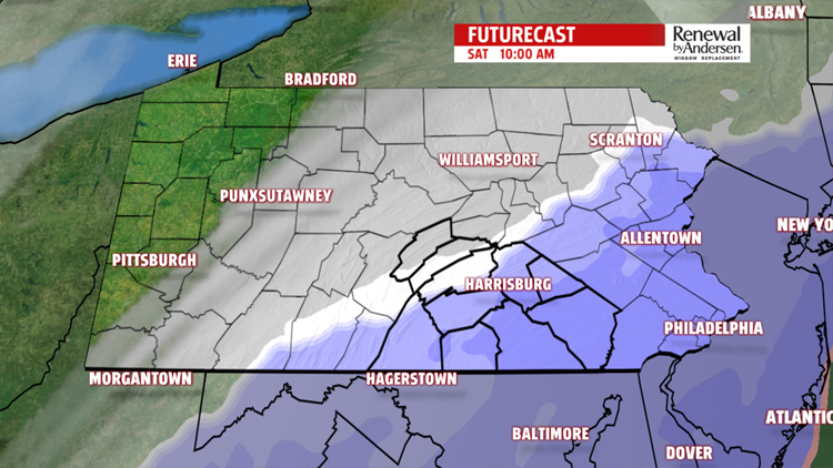


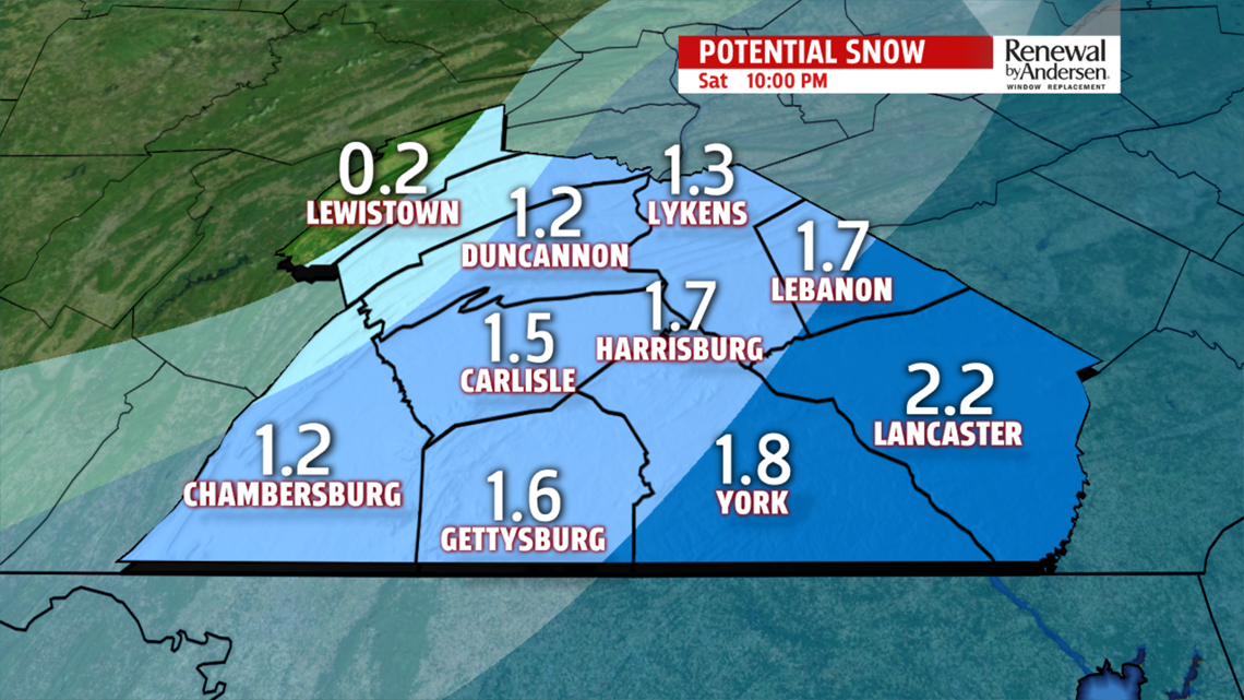
SNOW POTENTIAL: Highs stay in the low-to-mid 30s Saturday. We get clipped by a winter storm that has brought snow all the way from Houston to Mississippi and up the coast heading into Saturday morning and early afternoon. Snow totals are going to be very tough. Our current forecast holds the possibility of a 1-2″ for our eastern counties and decreasing as you head northwest. If the storm hugs the coast, we could see more. If it pushes east, we see less.

We’re continuing to monitor the potential outcomes with every model run as they update. We’ll give you the latest and best information coming out of the FOX43 weather office as it comes in as we continue to keep you “Weather Smart.”


STAYING COLD: Highs remain in the 30s throughout most of the 7-Day Forecast, with the potential for upper 20s area wide Wednesday afternoon. We’re breezy the entire work week, Monday through Friday of next week. Wind chills will likely remain in the upper teens to mid-20s throughout the forecast.

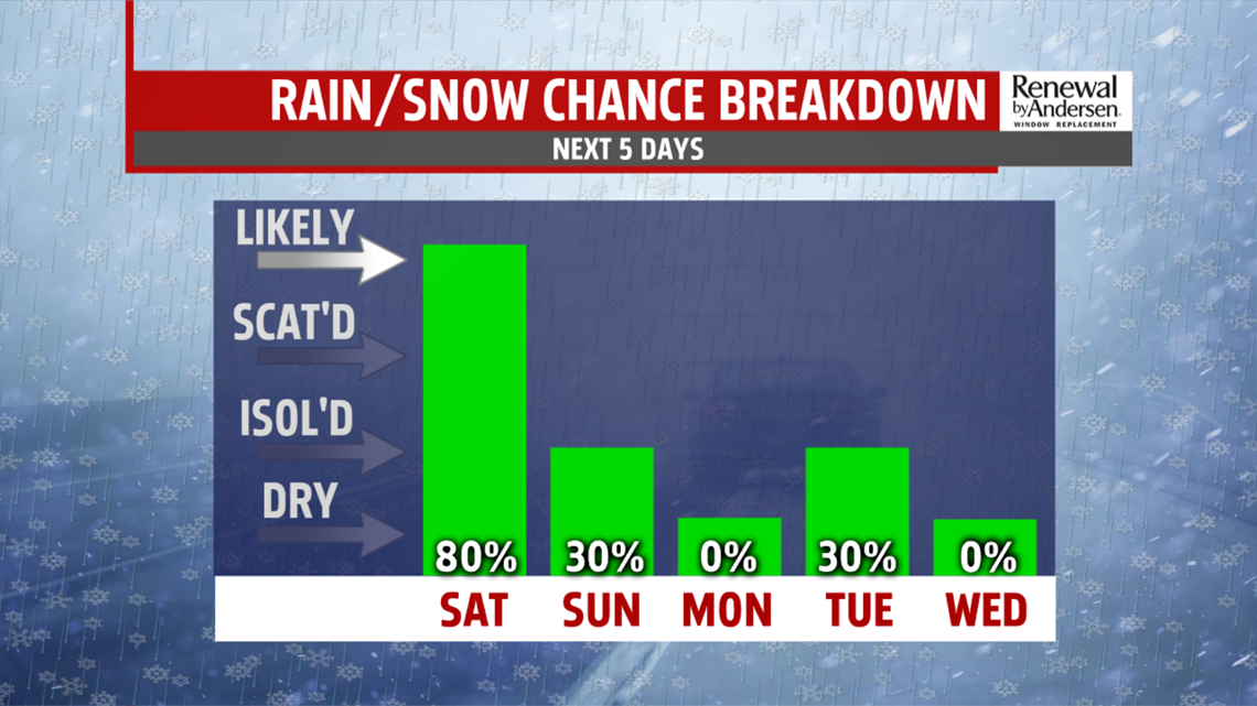
MORE SNOW POSSIBLE: Flurries are possible Sunday with more snow on the horizon for Tuesday. We get clipped again Thursday into Friday with more light snow possible. None of these storms look to bring a lot of accumulation to our area, if any. But, we will see flakes for a few days in the immediate forecast. Chief Meteorologist MaryEllen Pann, Meteorologist Andrea Michaels and I will continue to update you as soon as updates come in for our snowfall potential this week. Just bundle up, because it’s going to be cold!
Have a great weekend!
-Meteorologist Bradon Long
