

COLDEST AIR OF SEASON

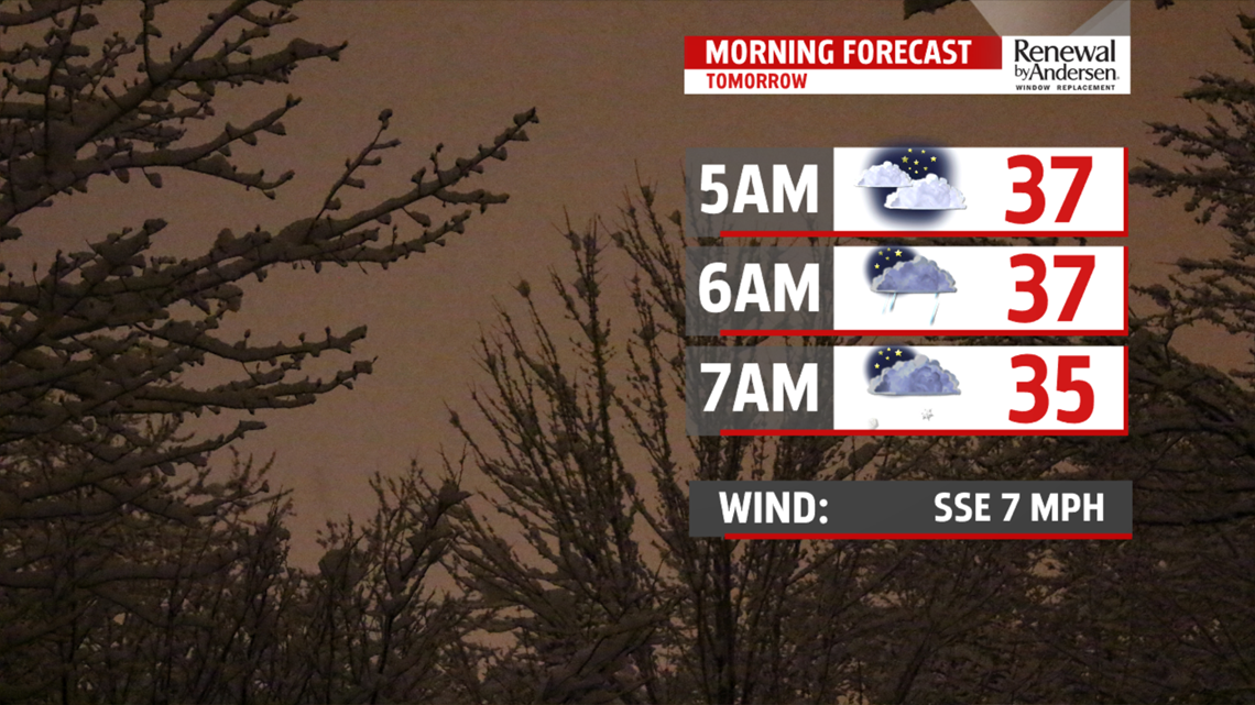
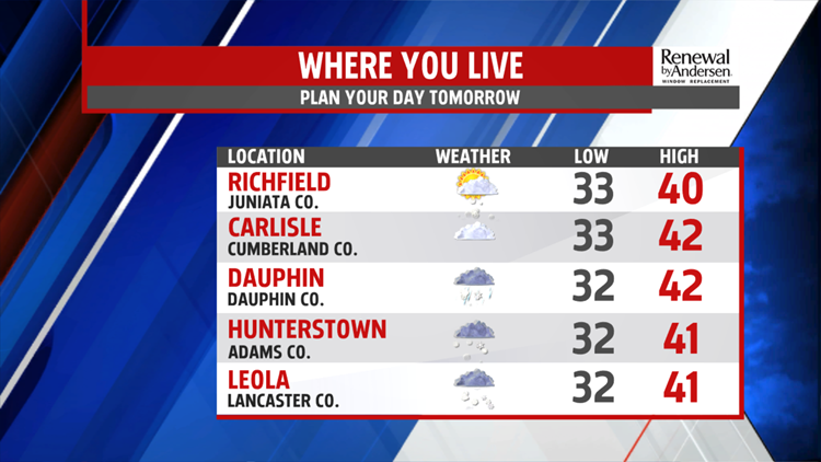
This evening is quiet with increasing clouds. Temperatures are very slow to fall and once clouds arrive, they hold steady in the lower and middle 30s. Overnight, a clipper type system passes by north of us and drags a cold front through the area. A few light snow
showers may develop towards morning then through the day, spotty rain and or snow showers are possible. More importantly to note is the blustery, frigid conditions that follow the system. Winds pick up Tuesday afternoon and

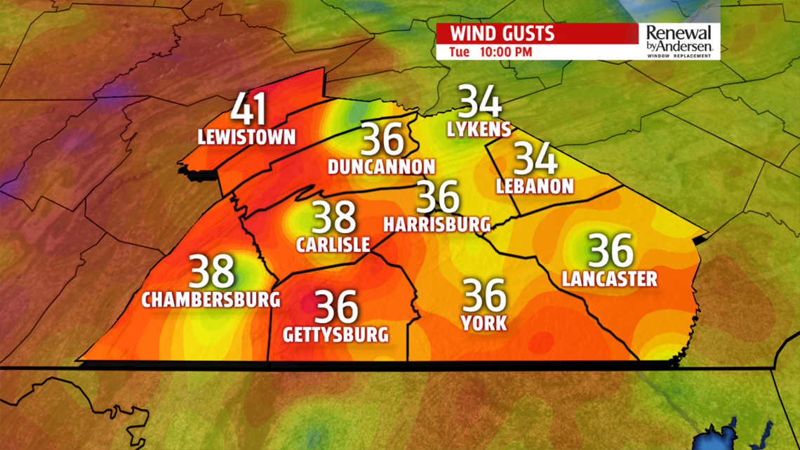
evening and gust through Wednesday before abating late Thursday. Gusts could reach 35mph or higher. With temperatures

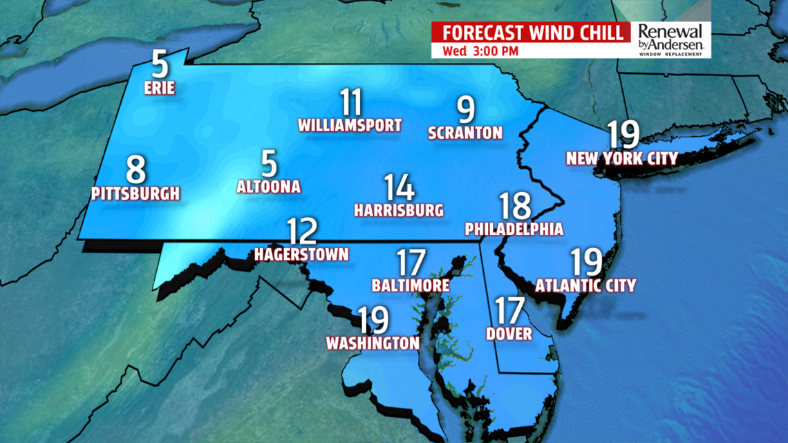
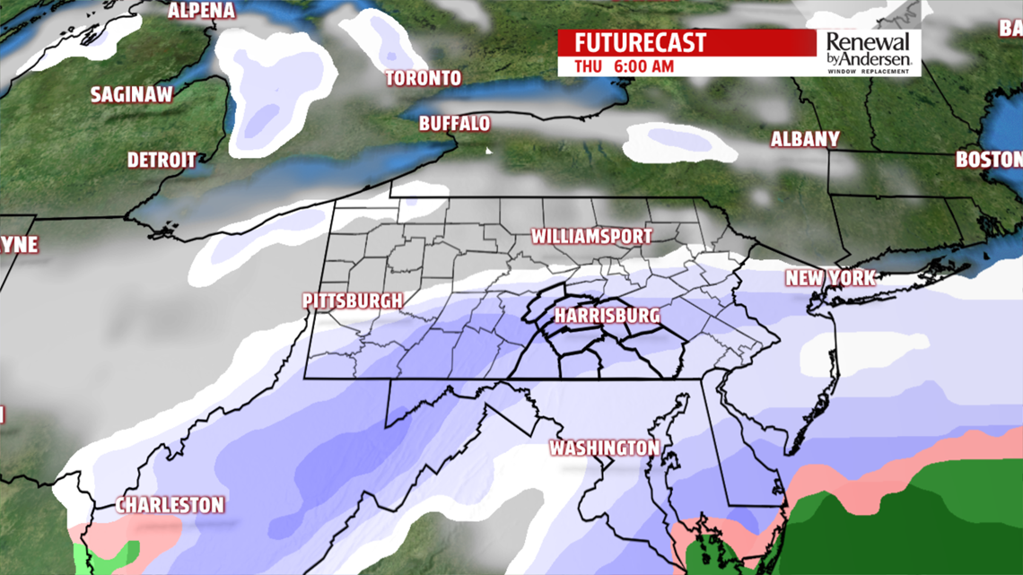
falling rather fast to the teens Wednesday morning, wind chill values are in the single digits. Afternoon readings only recover to the 20s but you’ll need to dress for single digits and teens with the strong winds continuing. On Thursday, another weak clipper brings light snow flurries and snow showers. Temperatures are below average in the upper 20s and lower 30s. Friday, again, a few light flurries or light snow showers are possible but temperatures are a tad better in the middle 30s.

WEEKEND WARM UP
Ridging in the upper levels returns for the weekend. This means milder more seasonable temperatures. We are near 40 Saturday but into the lower and middle 40s for Sunday and Monday. Next system comes through overnight Sunday into Monday, and brings rain showers for most of the area, except for possibly a mix farther north.
The FOX43 Weather Team is keeping you “Weather Smart” all week long!
Have a good day!
MaryEllen Pann,
Chief Meteorologist
