

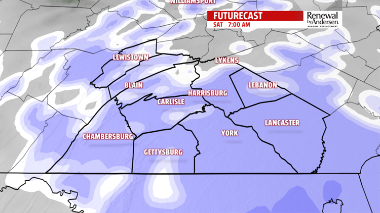
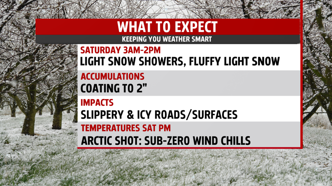
WEEKEND LIGHT SNOW
Clouds thicken through evening. Temperatures hover in the middle and upper teens. They don’t fall much overnight. Light snow develops late evening and continues through late morning before tapering by early afternoon. Gusty winds will produce bands of lake effect snow squalls through the afternoon. Slippery roads, on and off ramps, and sidewalks are likely so use caution. Expect a light fluffy snow, which will accumulate quickly. Accumulations of a coating up to 2 inches are possible. It’s a cold day with highs again in the middle 20s. Winds become quite gusty by evening bringing another frigid shot of Arctic air.

NEW YEAR’S EVE AND NEW YEAR’S DAY

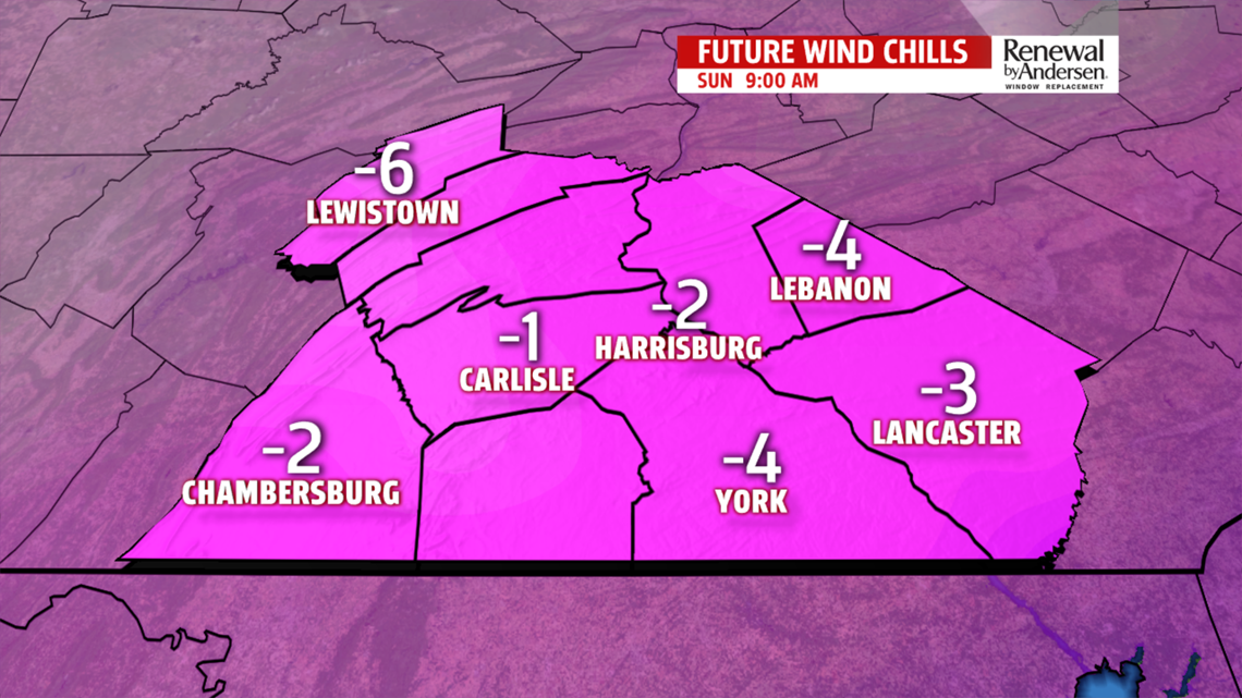
Celebrating outdoors New Year’s Eve, prepare for single digit to

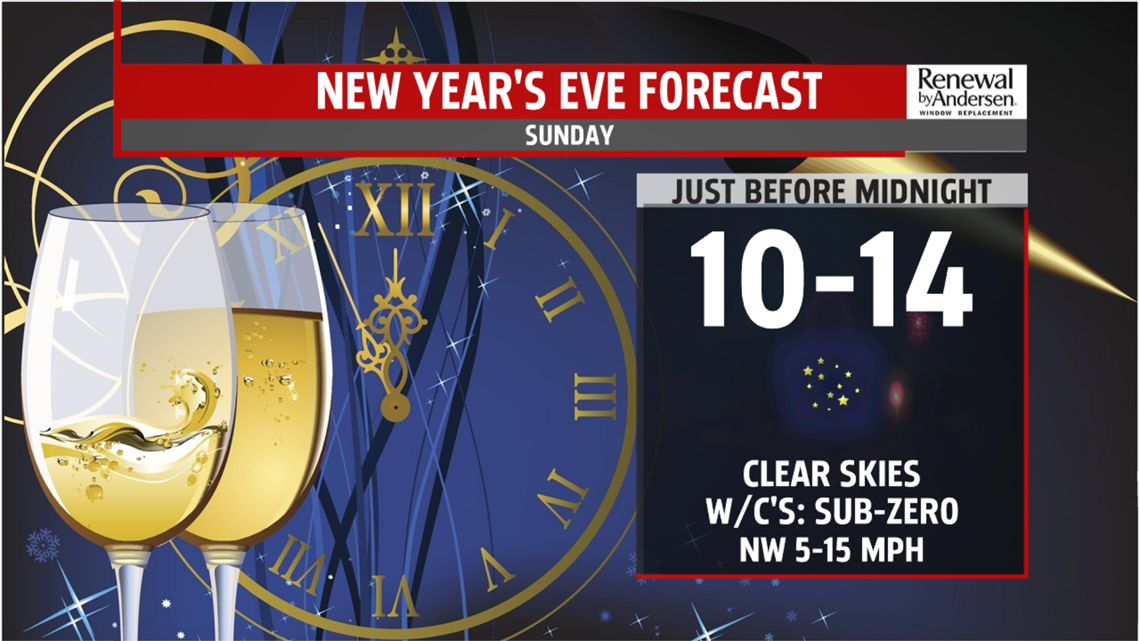
below zero wind chills. Overnight temperatures plummet to single digits, with wind chill values below zero. The wind will sting too. We bring in 2018, gusty and brutally cold, with afternoon highs only in the teens. Wind chill values are in the single digits all day.
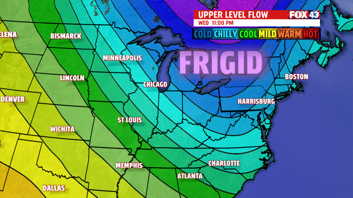
COLD NEW YEAR
Skies are bright Tuesday. While it is still a frigid start in the single digits, afternoon readings are back into the lower 20s. Heading into Wednesday, temperatures are not as cold in the middle and upper 20s. However, another deep Arctic air mass slams the area Thursday. The icebox airmass continues right into next weekend! Highs are in the upper teens and lower 20’s degrees for Thursday and Friday. Gusty winds return producing wind chill values in the single digits both days too.

The FOX43 Weather Team is keeping you “Weather Smart” all week long!
Have a good day!
MaryEllen Pann,
Chief Meteorologist
