


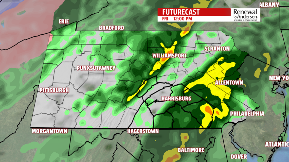
WARM AND RAINY: Rain fills in overnight tonight into Friday morning. Everyone sees a good soaking, so keep the umbrella out throughout the day. Light to occasionally heavy rainfall will fall off-and-on all day long.

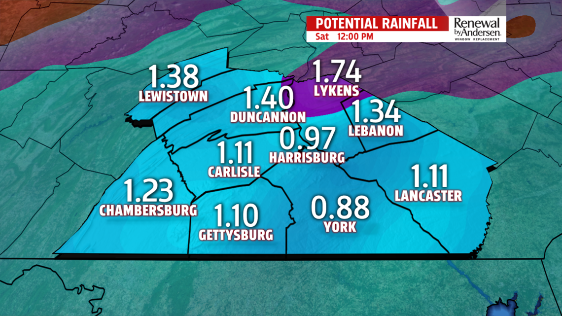
Highs near 60 with 1.5″ of rain looking likely for most of the area. As always, locally higher totals are possible.
MIX, TEMPS DROP QUICKLY: Temperatures drop quickly in the very early morning hours of Saturday. Our high is close to midnight with temperatures dropping nearly 30 degrees by the time the day is done.

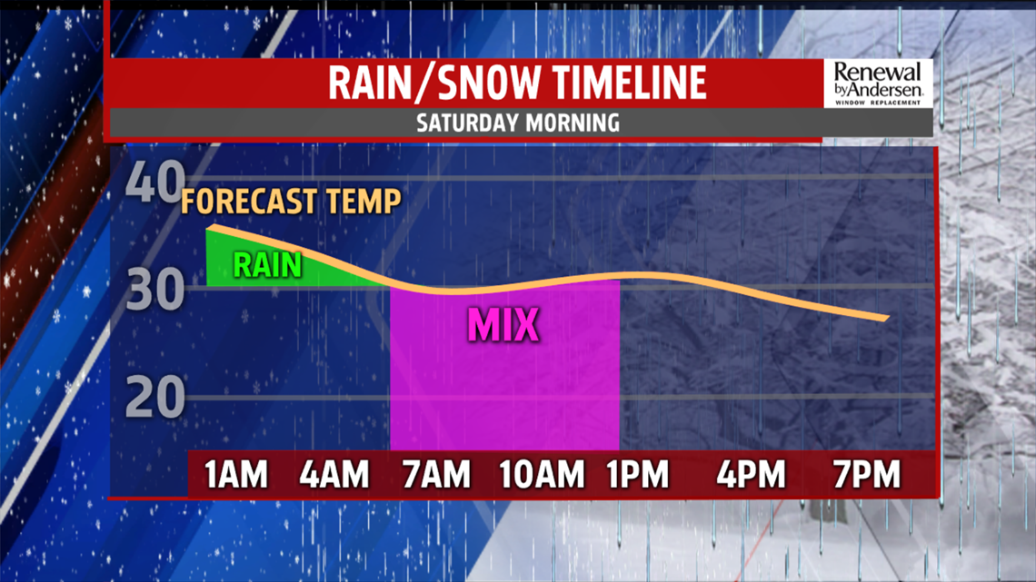
Rain will transition to a mix of sleet and snow as the sun rises on the weekend. Precipitation is done by the early afternoon and skies will begin to clear. Afternoon temperatures will be in the mid-to-upper 20s.
COLD, SNOW CHANCES: The cold air stays with us for the remainder of the Weather Smart Forecast. Light snow showers are possible for Tuesday and flurries for Wednesday in an otherwise quiet and cold period. Highs stay in the 20s and low 30s into next week with partly-to-mostly cloudy skies starting Monday.
Stay tuned for the latest updates heading into the weekend! We’ll give you the information you need to be Weather Smart.
-Meteorologist Bradon Long
