


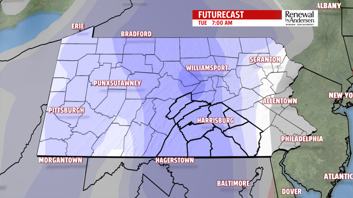
LATE SHOWER TURNS TO SNOW: Highs are just a bit cooler Monday, making from the upper-20s and low-30s in the morning to the mid-40s by afternoon. Skies remain mostly cloudy through Tuesday. There is a very low rain chance Monday night. Precipitation chances increase overnight and that change over to snow Tuesday morning. Accumulations will be light with highs only reaching the low-30s, but feel like the upper teens and low-20s all day thanks to breezy northwest winds gusting to 30MPH.
UP AND DOWN TEMPS: Temperatures stay in the low-to-mid 30s Wednesday. 5-10MPH winds switch from out of the north to out of the south by the end of the day with partly cloudy skies. Highs warm to the mid-40s by Thursday before falling back into the 20s and 30s Friday.

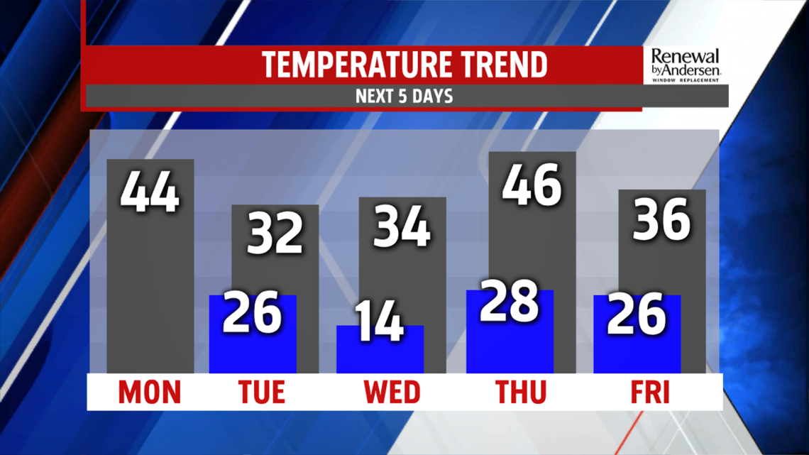
MORE RAIN/SNOW CHANCES: Late rain changes over to snow Thursday night into Friday morning. Winds ramp up out of the north at 10-15MPH before temperatures drop into the teens Saturday morning.
Have a great week!
-Meteorologist Bradon Long
