


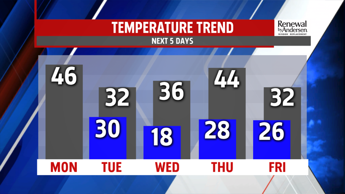
WINTRY MESS CHANCES: The next system brings a wintry mess to the region late Thursday and through the night. Most of the day is cloudy. Expect temperatures to make it into the lower 40s, but they fall fast through the night. This means rain showers transition to a brief, light wintry mix and then light snow through the night. It should exit by daybreak on Friday. It could be a messy night. Sunshine works in Friday, with another burst of cold air. Expect readings in the upper 20s to lower 30s with breezy conditions.
WEEKEND OUTLOOK: The cold remains in place through the upcoming weekend. Saturday skies start with sunshine, but clouds build ahead of the next system. Temperatures reach the lower 30s. We’re watching the chance for some scattered snow showers on Sunday with the next system. Expect afternoon high temperatures in the lower to middle 30s.
Have a great Monday!
