


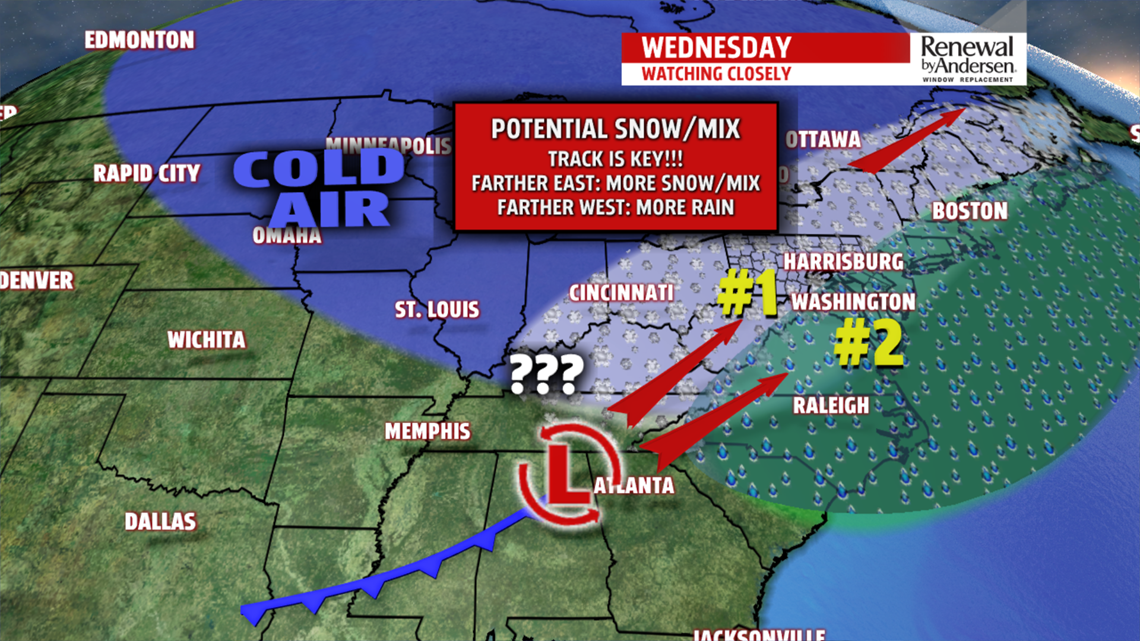
MORE WINTRY MIX CHANCES: Our next chance for a wintry mix arrives Wednesday morning, and likely lasts through early evening. It starts as snow and ice, then changes the rain and ice throughout the day for a good portion of the area. Track is a key question as always. A more west track means more rain works into the region as a whole. A track more east means more of the snow and icing. We’ll continue to watch this threat. Cold air slides in behind this system. Temperatures are in the middle to upper 20s Thursday under partly cloudy skies. It’s also a bit breezy. Friday brings the chance for an isolated snow shower, otherwise it’s mostly cloudy. Temperatures are in the lower to middle 30s.
WEEKEND WARMING: A warming trend takes place into the upcoming weekend. Saturday brings partly sunny skies. Temperatures reach the upper 30s to lower 40s. Sunday brings the chance for rain showers as the warming continues. Expect readings near the 50 degree mark.
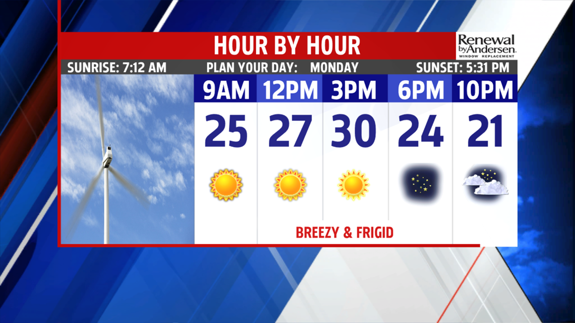
Have a great Monday!
