

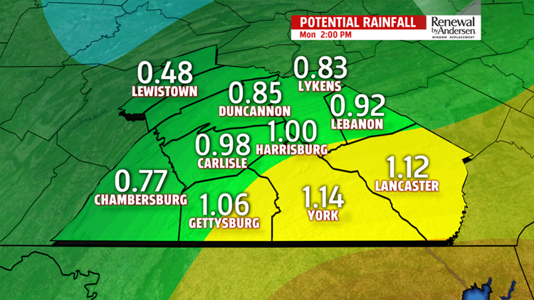


SHOWERS CONTINUE: Showers fill-in overnight into Sunday morning. The highest rain totals will be in the eastern counties, likely over an inch when all is said and done. Highs reach the upper-40s and low-50s on Sunday as rain ends by the afternoon.

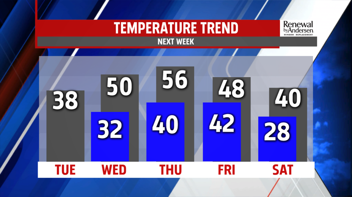
A BIT COOLER START TO THE WEEK: Temperatures drop as skies clear out Sunday night into Monday morning. We’re about 10-degrees cooler Monday with highs in the low-40s under partly cloudy skies. Morning lows drop to the low-20s Tuesday morning with highs in the upper-30s.
WARMER, MORE RAIN: We’re back to the upper-40s and low-50s for Valentine’s Day next Wednesday. Plenty of sunshine and light winds make for a good holiday weather-wise. We’re even warmer by Thursday with highs in the mid-50s. Showers move in towards the afternoon under otherwise mostly cloudy skies. Temperatures drop back into the low-40s heading into next weekend.
Have a great one!
-Meteorologist Bradon Long
