


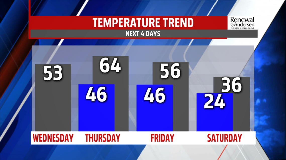
WEEKEND OUTLOOK: The weekend sees a chilly start on Saturday, but that doesn’t last long. Skies start sunny on Saturday, but we’re watching a system to the south that develops along a stalled front. Computer models are indicating a wave that rides along it, and it could come close enough to us for some snow Saturday evening and overnight. If it’s far enough north, some could even see some brief mixing. We’ll monitor the trends and keep you updated on this new development. Temperatures are chilly, with readings in the 30s. The clouds are out of here by Sunday, with plenty of sunshine. Some clouds could try to sneak in much later during the day, but sunshine is abundant either way. Temperatures take a milder turn. They are in the middle to upper 40s.
NEXT WEEK: Monday brings the next chance for showers. Timing looks like it’s trending later into the day. It’s still mild with temperatures in the middle 40s to lower 50s. Shower chances likely linger into Tuesday. The best chance right now is during the morning, with skies turning partly sunny during the afternoon. Temperatures could be quite warm, with readings potentially pushing 60 degrees!
Have a great Wednesday!
