


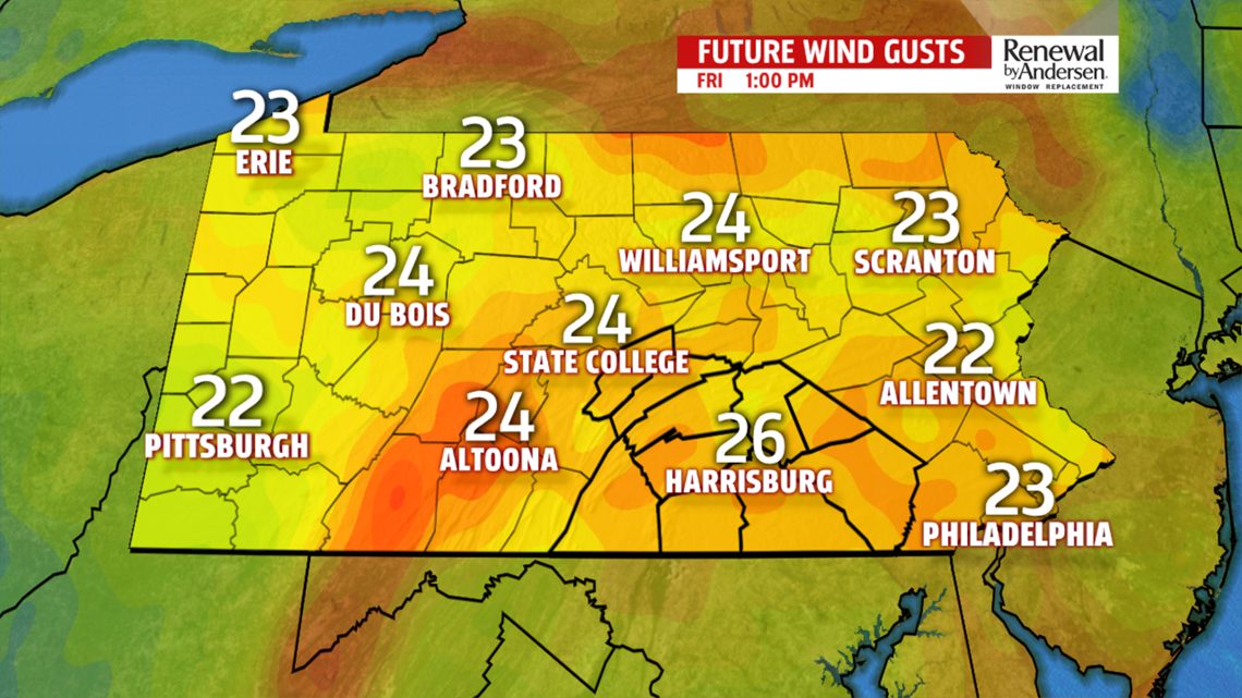
FLURRIES, BREEZY: A few snow showers from the west may sneak into our area for the early morning commute. Don’t expect any impacts in our area from snowfall, but we may see a few flurries. Winds are breezy again, out of the west-northwest at 10-15MPH with gusts up to 25MPH. Highs reach the low-40s after a start in the upper-20s.
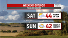

COOL BUT QUIET WEEKEND: A cool, but nice weekend ahead! Highs make the mid-40s as we remain dry both days. Winds calm down a bit, too, with partly cloudy skies throughout. The chance for a light mix looks to stay to our south, but it would be a near miss Sunday evening. I’m keeping an eye on it.

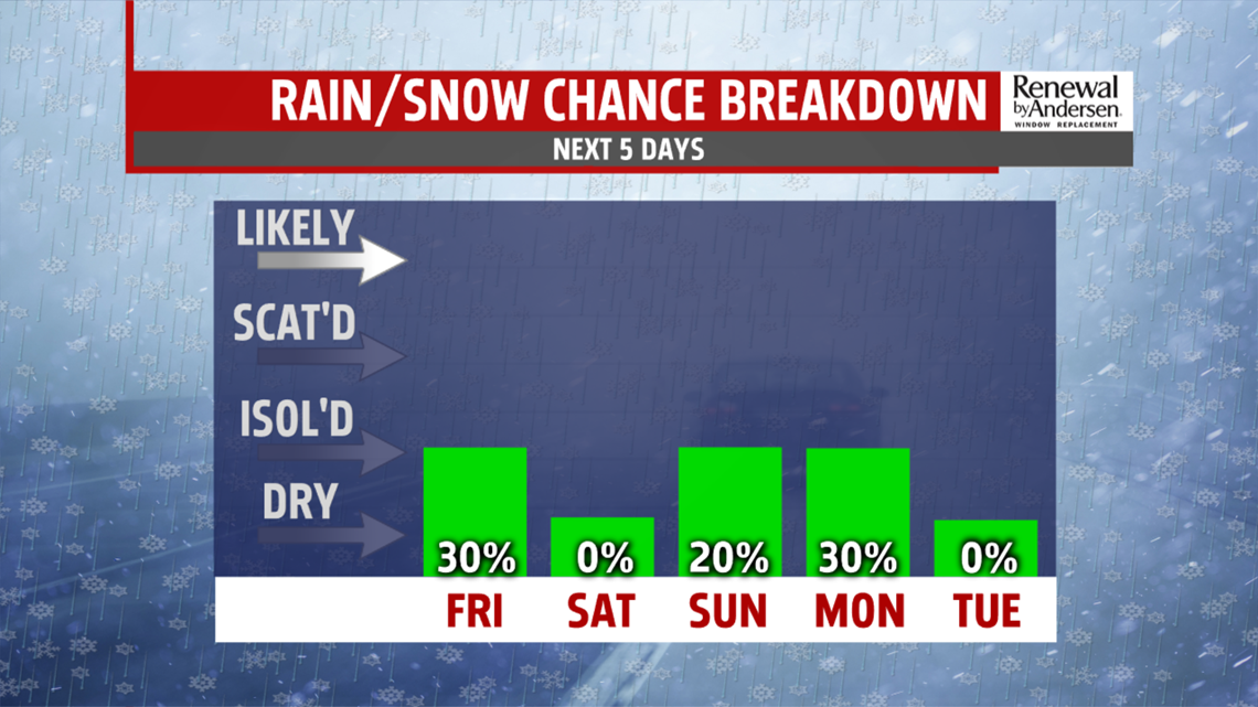
MORE FLURRIES CHANCES: A few flurries will be possible throughout next week depending on the track of the next storm system into Monday morning. Temperatures hover right around the 40-degree mark for the extended portion of the Weather Smart Forecast with more flurry chances next Wednesday night into Thursday morning.


Have a great one!
-Meteorologist Bradon Long
