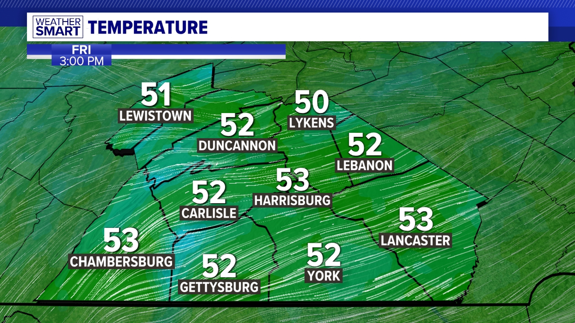
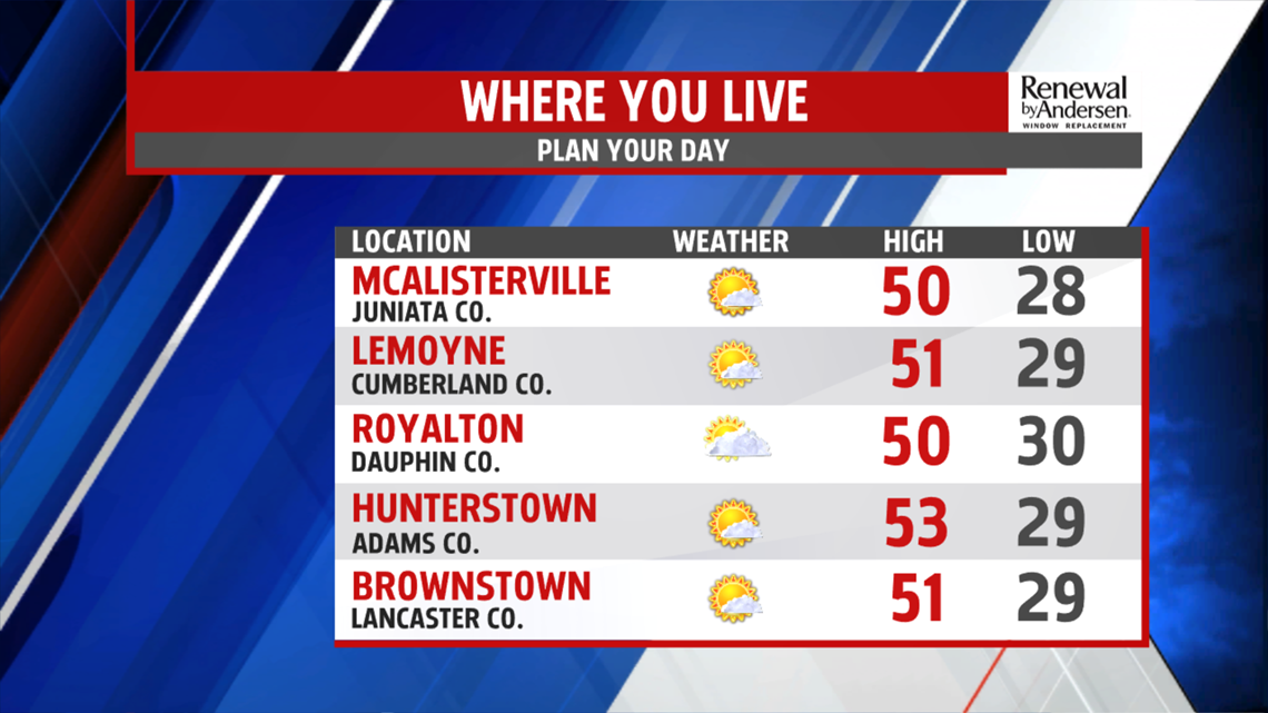
ANOTHER NICE ONE: Another mild one on tap to start the work week. Highs hover around the 50-degree mark by the time all is said and done for Monday. We’ll see plenty of sunshine with light winds. Lows overnight drop into the upper-20s and low-30s once again heading into Tuesday morning.
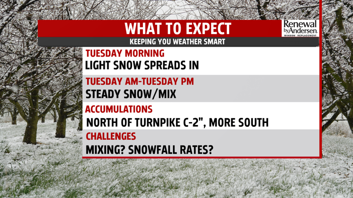
SNOW MOVES IN: The challenge continues for snowfall predictions heading into Tuesday. The latest model runs have tracked a bit north again just before the event. This slight jog currently raises our snowfall projections. However, much can still change, so stay tuned. The current forecast calls for a coating-to-two inches of snow for much of Central PA, with more snow expected south of the PA-Turnpike.

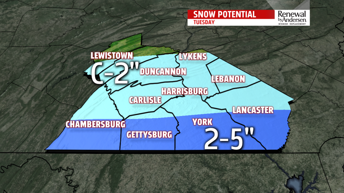
Precipitation will start early Tuesday morning and will impact the morning commute. Light-to-moderate snowfall lasts for most of the day and will end before sunrise Wednesday.
THE REST OF THE WEEK: A bit of a breeze comes back after our snow ends, with gusts up to 20MPH likely. This makes for a chilly Wednesday afternoon with highs hovering around 40. We gradually warm up to finish the work week with highs trying to reach 50 by Saturday with partly cloudy skies throughout.