


EASTER WEEKEND: Morning lows Saturday start in the 30s, but temperatures jump into the mid-50s with lots of sunshine. Winds will be breezy at times. Clouds move in late into Sunday morning as a weak disturbance could bring a stray shower our way Easter morning. The clouds stay around as highs try to reach the 50-degree mark for Easter Sunday.


ANOTHER SNOW CHANCE: A small-in-size but piece of energy with a punch currently tracks our way for Monday morning. We could be just cold enough for snowfall to try to accumulate in our southern counties. Any slight deviation in track over the next couple of days will change the forecast, so we still have plenty of time to go to iron out all the details. Right now, snow will be possible Monday morning with clouds sticking around the rest of Monday. Highs jump into the mid-40s by Monday afternoon.
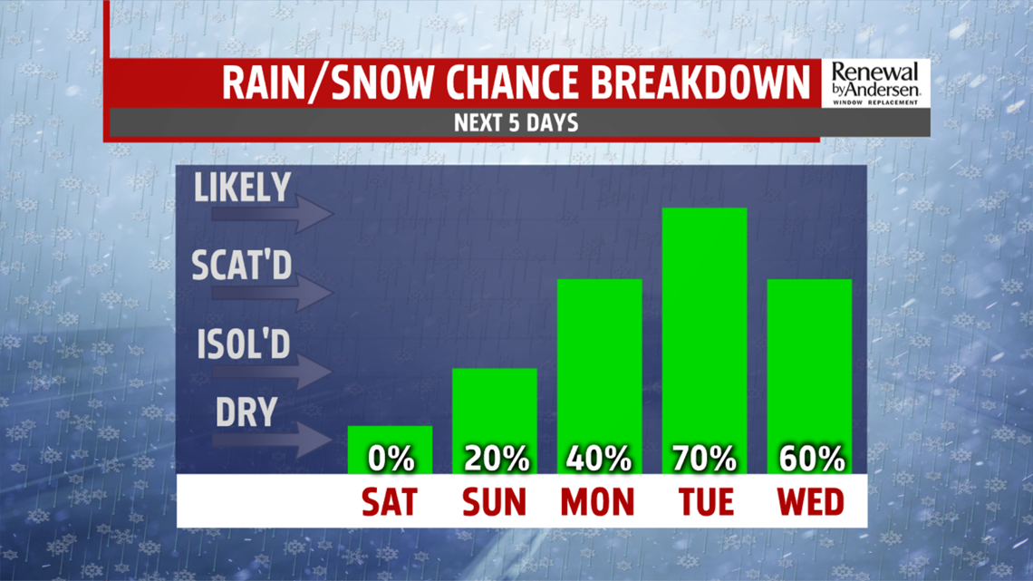
SHOWERS EARLY NEXT WEEK: Temperatures rebound into the 50s for Tuesday and Wednesday, but with rain chances most of the day on Tuesday with strong southerly winds. Rain ends during the morning hours of Wednesday but the winds stick around, out of the west-northwest at 10-15MPH. Temperatures hover around 50 for the rest of the Weather Smart Forecast.
Have a wonderful holiday weekend!
-Meteorologist Bradon Long
