


ENDING THE WEEK: A warm front lifts over the area tomorrow morning, bringing a mix of rain and snow for the morning commute. Accumulations look minimal on grassy surfaces, but the slightest change of the path of the warm front may give us a bit more or less precipitation. Highs reach the mid-50s across the area with warmer temperatures along the Mason-Dixon. The warm front dips south heading into Saturday morning.
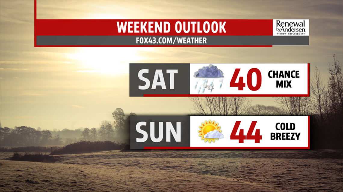
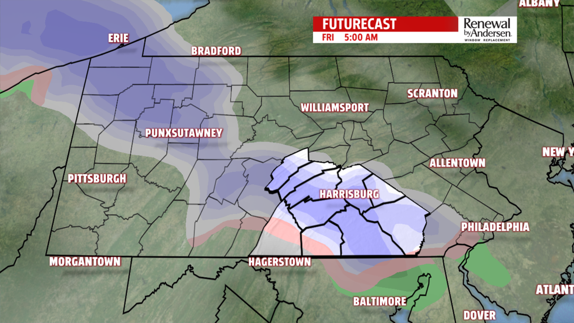
PRECIP, STAYING COLD: As the front dips south, we likely see another mix of snow turning to rain for Saturday morning. Accumulations, again, look minimal but we could see some along the grassy surfaces towards the south. After the accompanying cold front kicks the moisture out of our area, we get a cold and breezy Sunday with lots of sunshine. Highs stay in the upper-30s and low-40s for Saturday with mostly cloudy skies. Temperatures are only a few degrees better for Sunday with wind chills in the 30s all afternoon.
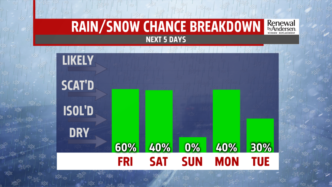
SHOWERS NEXT WEEK: Another chance for a winter mix starts off the work week on Monday. Winds are breezy once again with highs near 40. After that, we slowly warm up throughout the week with rain chances Tuesday, highs in the 40s, and next Thursday. Highs try to reach 50 for Wednesday and the upper-50s by the end of the Weather Smart Forecast on next Thursday.
Have a great one!
-Meteorologist Bradon Long
