
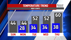


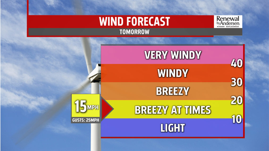
ANOTHER COLD ONE: Winds stay blustery out of the northwest at 10-15MPH for Sunday, but with more sunshine. Highs reach the low-to-mid 40s after a morning low in the mid-20s.
PRECIP CHANCES: A very low chance of a wintry mix remains in the forecast for midday Monday. Temperatures start in the upper-20s with highs in the mid-40s. We see more cloud cover to start the work week, with lighter winds. More rain chances move into the forecast, though low, for Tuesday morning and Thursday afternoon.

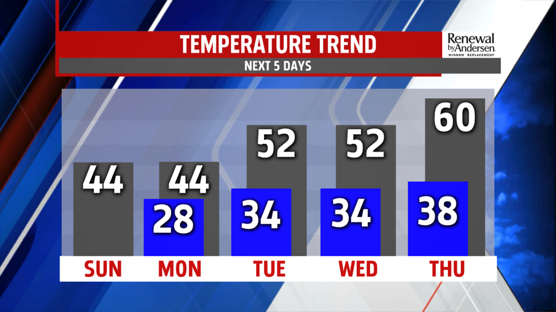
TEMPS SLOWLY WARM: After another high in the 40s Tuesday. temperatures rise to the low-50s for Tuesday and Wednesday. We then jump into the low-60s Thursday through Saturday with a bit more sunshine on Friday before clouds come back next Saturday.
Have a great one!
-Meteorologist Bradon Long
