


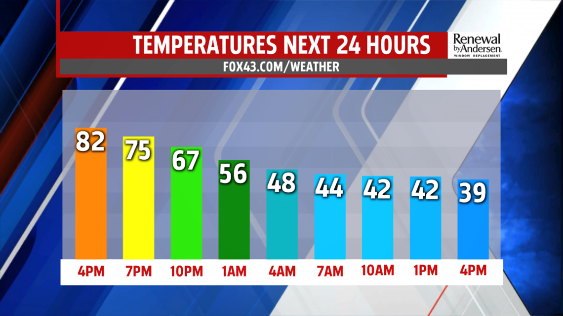
RAIN MOVES IN: Temperatures are warmest in the morning hours with cloudy skies. Out the door, we’ll be in the 60s. As showers begin to fall in the early afternoon, we’ll drop into the 50s and 40s. If the front moves through fast enough, we may even drop into the upper-30s.
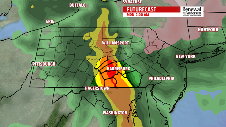
Rain will be light for Sunday before the main line comes through Monday morning. Don’t expect any dry afternoon plans for most of the area.
STARTING THE WORK WEEK: Showers intensify overnight and we may hear a few rumbles of thunder. Showers continue into the early afternoon before fading out.

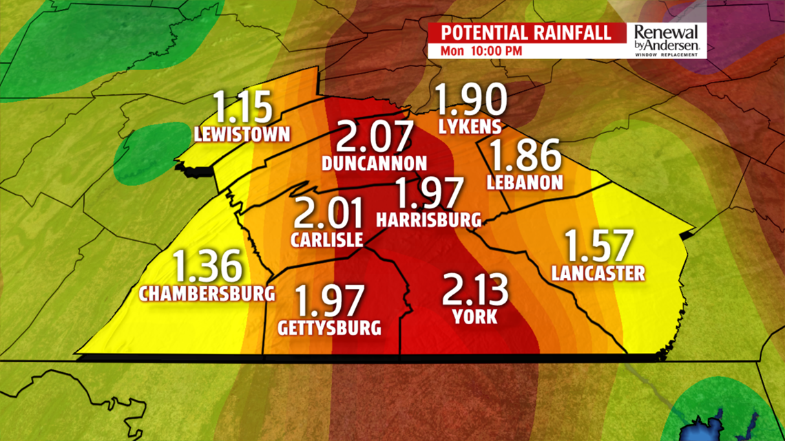
When all is said and done, a widespread 1-2 inches of rain looks likely for the entire area, with isolated higher amounts likely. We don’t leave the 50s with overcast skies throughout Monday and breezy conditions.
COOLER NEXT WEEK: Temperatures don’t leave the 40s Tuesday with mostly cloudy skies and breezy westerly winds.
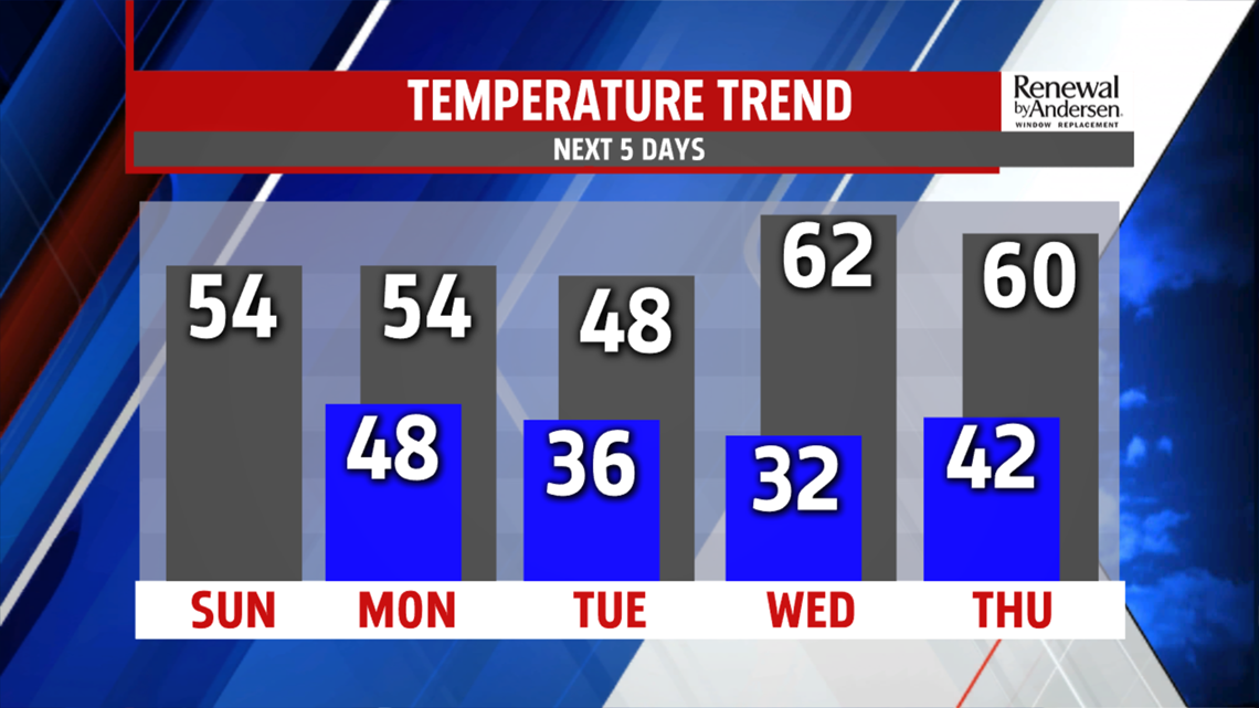
Wind chills are in the upper-30s with a few morning flurries not out of the question. We see the low-60s return for Wednesday and Thursday as the breeze sticks around. A cool front pushes through the area Thursday, bringing another light rain chance and dropping temperatures down into the 50s again heading into the weekend.
Have a great one!
-Meteorologist Bradon Long
