


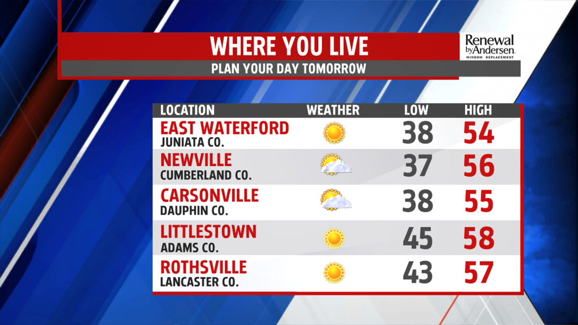
COOLER SUNDAY: Another round of showers move in throughout the evening hours. Most of the rain should be out of our southeastern counties by midnight. Lows drop into the upper-30s with clouds hanging around. Highs tomorrow only make it into the mid-50s thanks to northwesterly winds. Temperatures get a big jump as skies clear, giving way to abundant sunshine and highs back into the mid-60s by Monday.

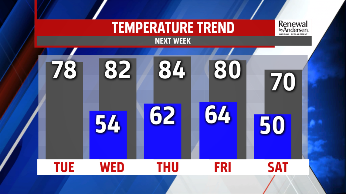
WARMING UP: Warmer air takes control by Tuesday. Morning lows are in the mid-40s Tuesday under mostly sunny skies. Highs hit the mid-to-upper 70s. We eclipse 80 with morning lows in the 50s for Wednesday. Our next rain chances hold off until Thursday, but the chances currently are low and aren’t forecasted to keep our temperatures out of the 80s to finish the week.
Have a great one!
-Meteorologist Bradon Long
