

HEAT AND HUMIDITY RETURN

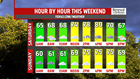
WEEKEND NOT A COMPLETE WASHOUT
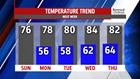
Most of Saturday right now is dry but as the day heats up, and a front stalled nearby, showers and thunderstorms become more likely. You’ll need to keep an eye to the sky if you are planning on being outdoors. Highs top out near 80 degrees. Showers lingering into early Sunday, however, the rest of the day is much drier. Clouds are slow to break but sunshine is expected, especially, later in the day. Readings are near seasonable averages in the middle and upper 70s.
NEXT WEEK
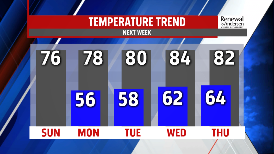
Cool start to the day in the middle 50s. Very comfortable too. Skies are partly cloudy and afternoon temperatures top out in the upper 70s. Another dry day expected Tuesday with in and out sunshine. Highs are warmer in the lower 80s. Next system brings very low chance for a late day shower or thunderstorm Wednesday. Ahead of the front, temperatures warm into the lower and middle 80s. Expect plenty of sunshine Thursday and warm temperatures still in the 80s!
The FOX43 Weather Team is keeping you “Weather Smart” 7 days a week!
Have a good day!
MaryEllen Pann,
Chief Meteorologist
