
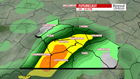


SATURDAY STORMS: We see sunshine to start with partly cloudy skies most of Saturday. Lows start in the mid-60s with highs in the low-80s. Thunderstorms start in the late afternoon and last till the evening. A few could last after sunset. These are not expected to be severe. Southern Franklin County is in a very-low risk for severe storms. On a scale of 1-to-5, it’s a 1 with gusty winds being the main threat. We could see occasionally heavy downpours with any thunderstorms we do see.
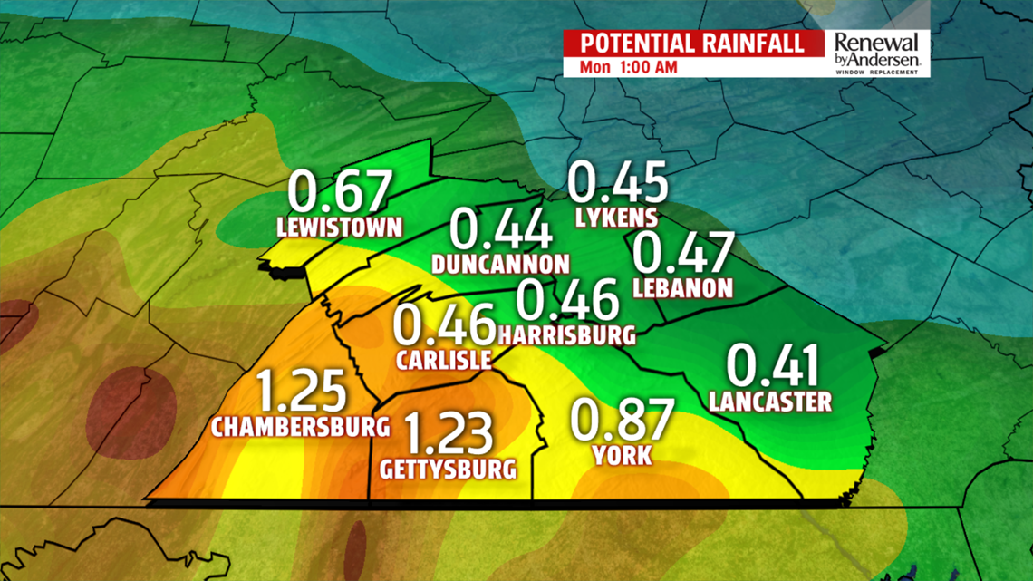
SUNDAY SHOWERS: We get a brief break overnight before scattered showers develop into the morning. Your morning drive to church will be wet in spots, with increasing showers by Noon. Showers end in the early afternoon with a few sprinkles lingering. Skies stay cloudy with highs in the mid-70s. The highest rain totals from both Saturday and Sunday will likely be close to the Mason-Dixon, with 1″ in spots possible.

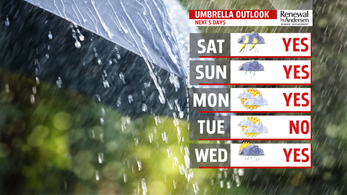
NEXT WEEK: A few more showers are likely Monday morning, ending by early afternoon. Highs stay in the mid-70s with mostly cloudy conditions. We stay partly-to-mostly cloudy all week long with highs reaching the 80s again by Wednesday. We’re dry Tuesday with thunderstorm chances Wednesday afternoon. Thursday is quiet with partly cloudy skies before more thunderstorm chances again Friday afternoon.
Have a great weekend!
-Meteorologist Bradon Long
