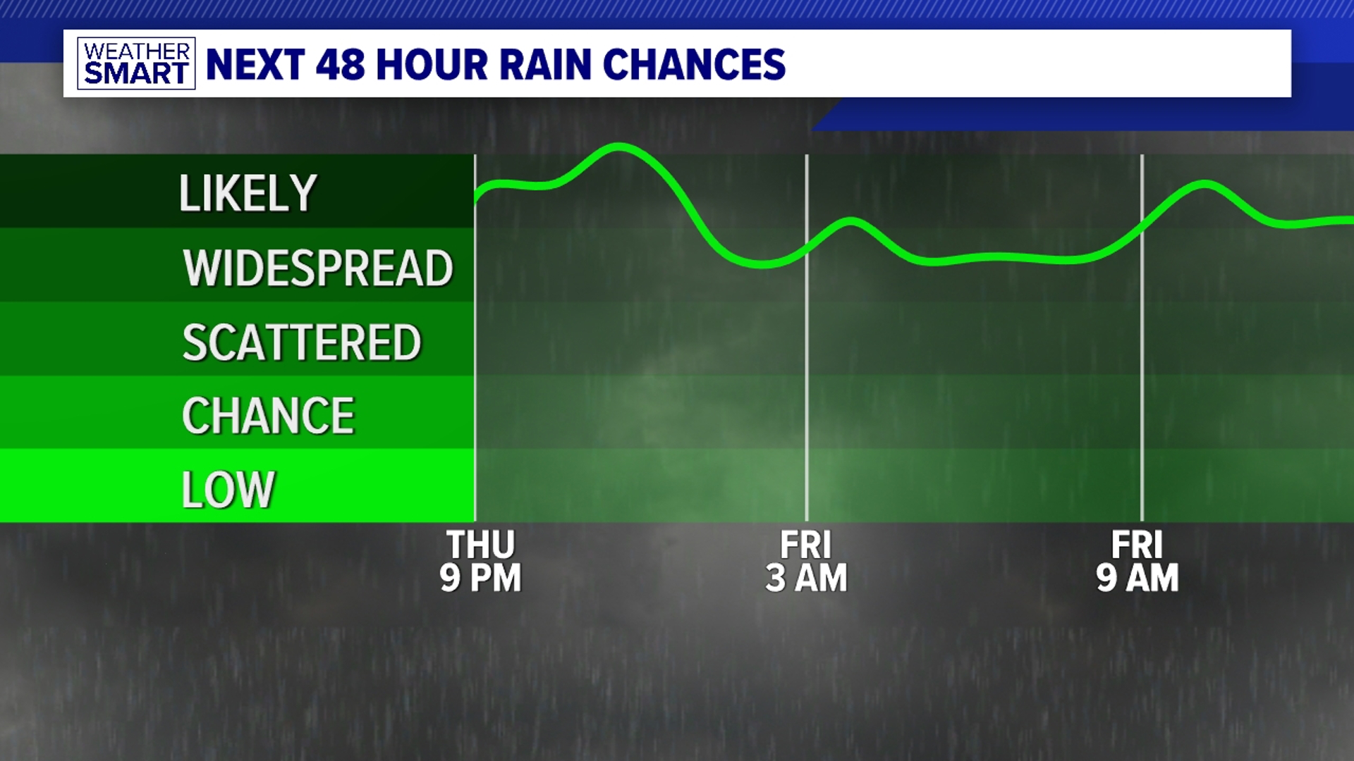
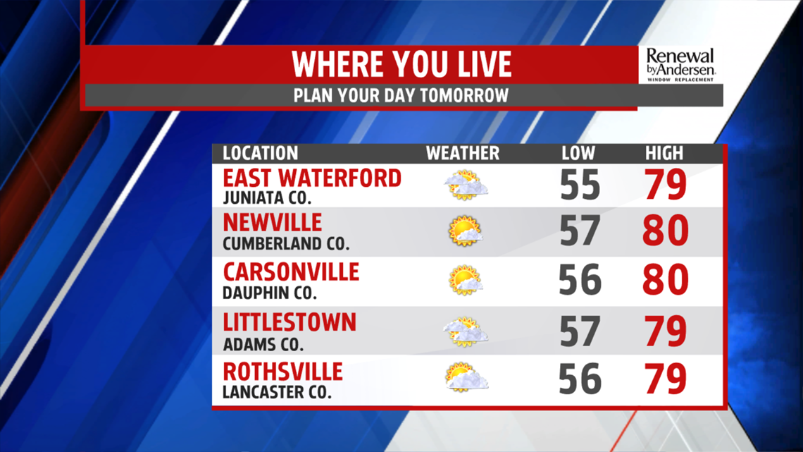
ENTERING THE WEEKEND: Temperatures hold in the 70s throughout much of the evening. We dip into the 60s and upper-50s for morning lows. Light winds and mostly sunny skies give a near perfect end to the work week with low humidity and a high near-80 degrees. We gain a couple of degrees and a few more clouds Saturday, with morning lows in the mid-to-upper 50s, highs in the low-80s under partly cloudy skies. We stay dry.

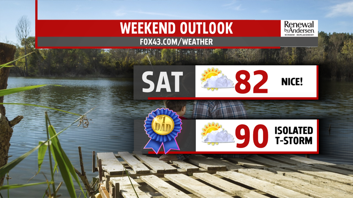
FATHER’S DAY AND MONDAY: A stray thunderstorm can’t be ruled out Father’s Day. Humidity gets a pretty good crank up with highs nearing 90 under partly cloudy skies. We’re even hotter Monday with morning lows around 70-degrees and highs in the mid-90s. The “feels-like” temperature will be in the low-100s. A stray thunderstorm can’t be ruled out, but most places stay dry.
NEXT STORM CHANCES: Our next significant thunderstorm chance comes Tuesday ahead of a weak cool front. Based on humidity and high temperature alone (starting in the 70s and highs in the upper-80s) we feel very hot. Thunderstorms pop-up in the mid-to-late afternoon. They could be strong. We then cool to the low-80s for next Wednesday with a chance of afternoon thunderstorms once again.
Have a great one!
-Meteorologist Bradon Long