

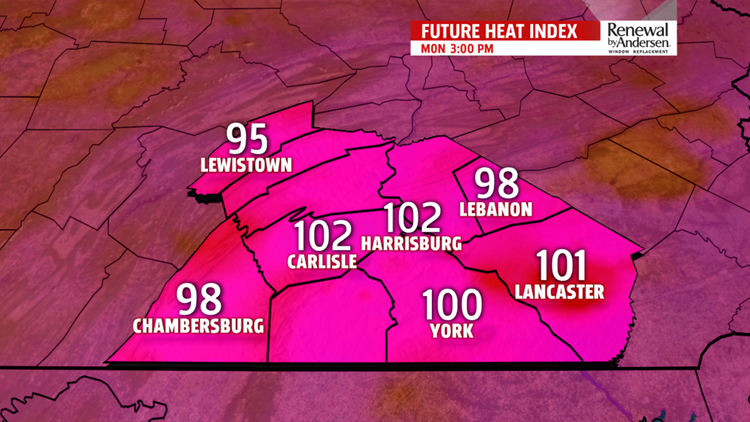


HOT, HUMID AND DANGEROUS: We crank up the humidity another notch to start the work week. Morning lows start in the low-70s with highs in the mid-90s. Because of the increased humidity, our “feels-like” temperatures will be in the 100-105 degree range. A HEAT ADVISORY is in effect for the entire area from Noon until 8PM Monday. Limit time outside and make sure to stay hydrated! A stray thunderstorm can’t be ruled out as well.
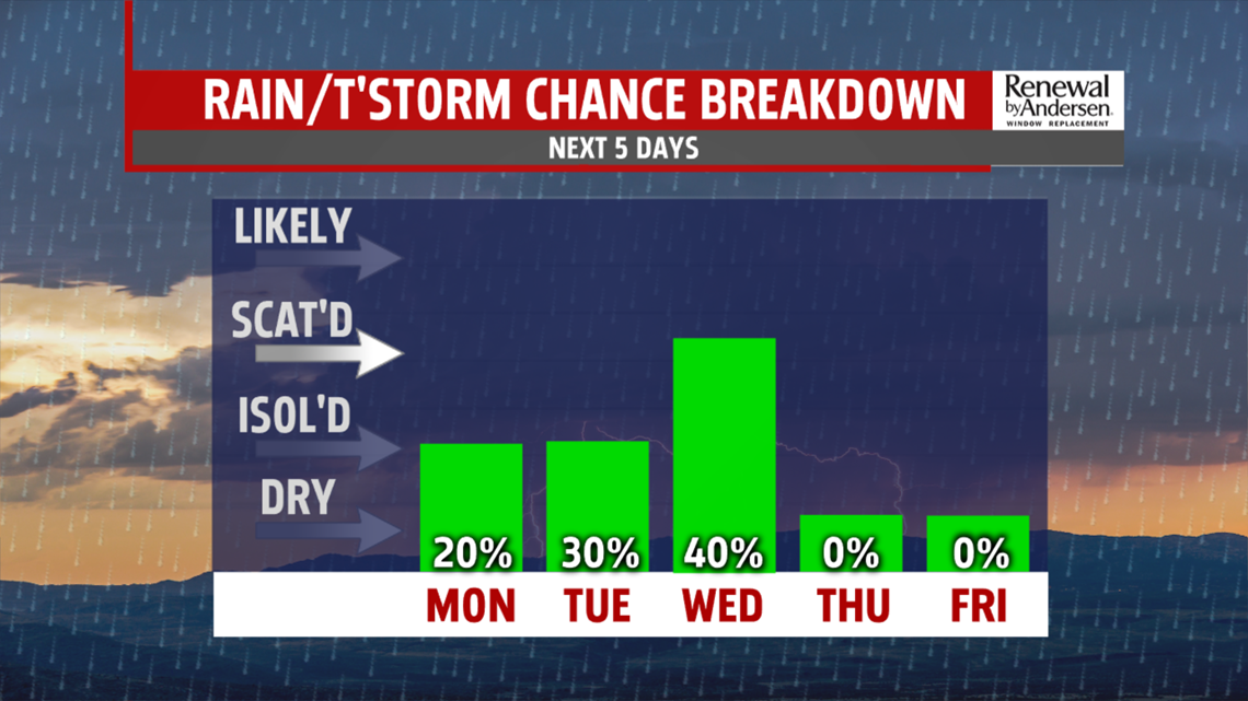
THUNDERSTORM CHANCES: Higher thunderstorm chances move in Tuesday and Wednesday. Morning temperatures are in the mid-70s Tuesday for another very hot start. Partly-to-mostly cloudy skies hold us in the upper-80s with thunderstorm chances for the afternoon. These could be strong-to-severe. We’re cooler Wednesday with slightly less humidity and highs in the mid-80s. Afternoon thunderstorms once again will be possible, especially in our southern counties.
HEADING INTO NEXT WEEKEND: We enjoy much less humidity for Thursday and Friday with highs in the low-to-mid 80s with partly-to-mostly cloudy skies. Winds stay light all week long. Current guidance suggests a few thunderstorms possible next Saturday and Sunday as temperatures rise near 90 by next Sunday.
Have a great one!
-Meteorologist Bradon Long
