


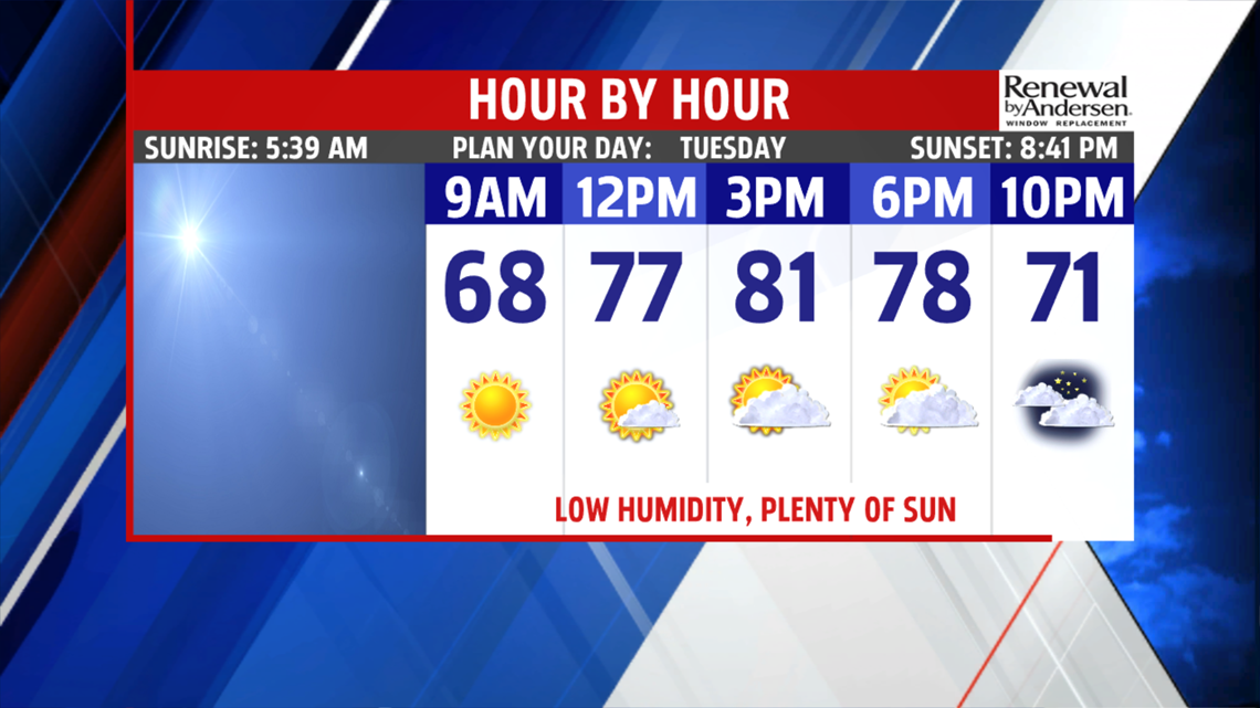


ANOTHER COMFY DAY: Canadian high pressure remains in control for Tuesday, so it’s another wonderful, summery day for the region. Temperatures are cool in many spots to start, with readings in the 50s to near 60 degrees. There’s plenty of sunshine throughout the day. Only some high clouds pass through during the morning and into early afternoon. Eventually, the clouds start to thicken later during the day. Temperatures reach upper 70s to lower 80s. Humidity levels remain very pleasant, and the winds are lighter. The overnight period starts to see more clouds, but it is dry for most of the night. Lows are milder, with readings in the upper 50s to middle 60s. A few showers are possible near, if not slightly after daybreak.
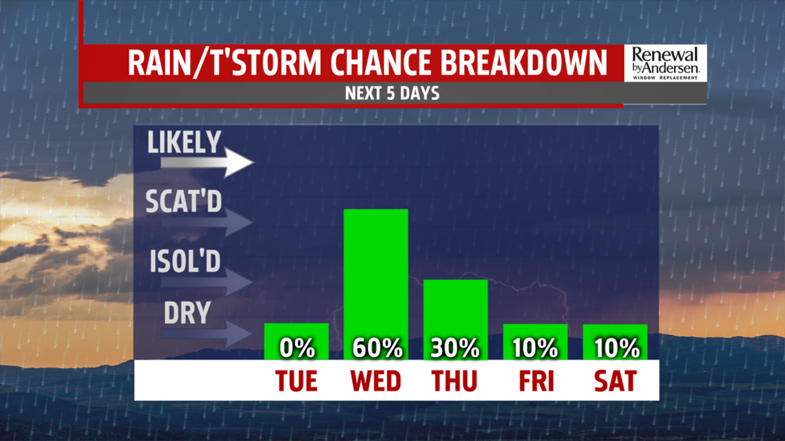
WARMING WITH STORM CHANCES: Wednesday is unsettled as the next system passes through, so the day comes with some shower and storm chances. Some morning showers are possible, then expect some breaks closer to midday. It turns humid, with temperatures in the lower to middle 80s. There’s the chance for more showers and thunderstorms during the afternoon, and that chance continues through the night. Thursday brings a chance for a few showers and thunderstorms as well, especially for the first half of the day. Sunshine should increase during the afternoon. It’s muggy and warm, with readings in the lower to middle 80s.


Have a great Tuesday!
