

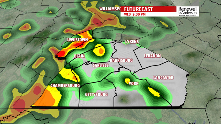

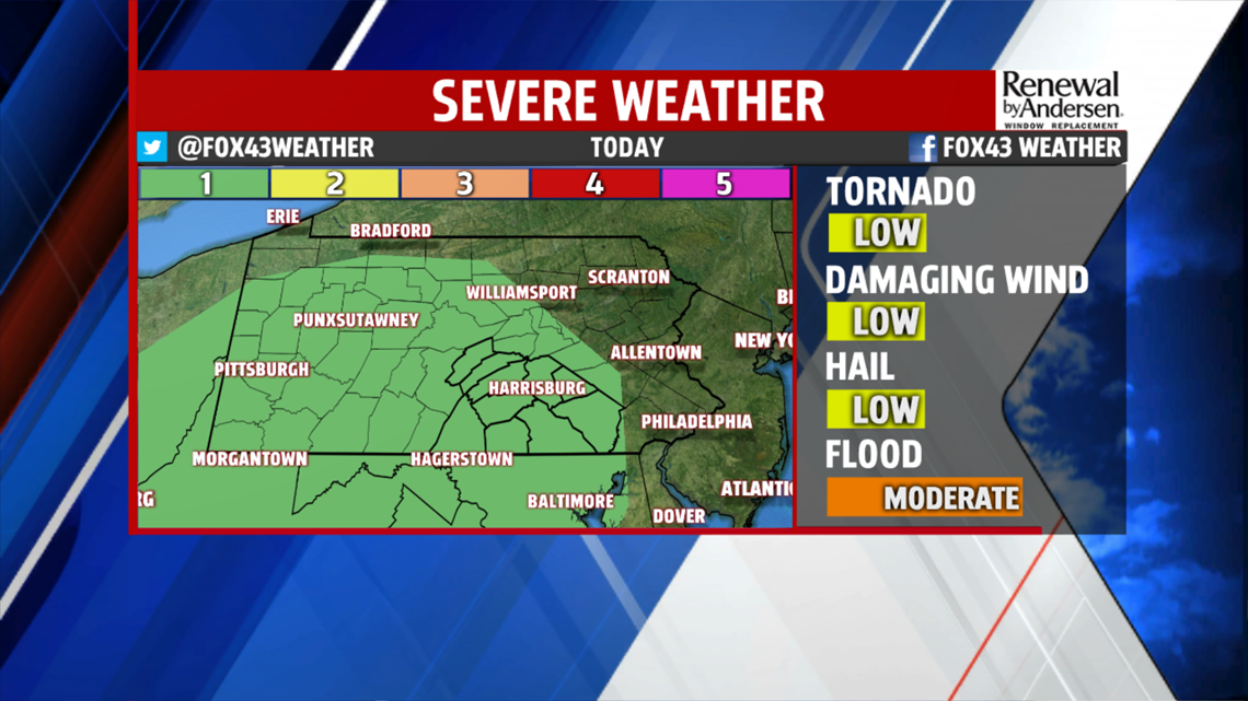
THUNDERSTORMS TODAY: Spotty showers start the morning and will continue off-and-on throughout the morning. The more showers and cloud cover we have this morning, the lower our severe threat becomes later in the afternoon. Regardless, we do have a low threat of severe weather this afternoon.


On a scale of 1-to-5, we’re at a 1. Wind will be the main threat, will a low threat for hail and an isolated tornado. The bulk of the thunderstorm activity starts late in the afternoon and continues throughout the evening, even for a period of time after dark. Any leftover spotty showers wrap up by early Thursday.
DRYING OUT: We begin a warming trend Thursday. After those few morning showers, the humidity sticks around with temperatures topping out in the mid-to-upper 80s. We see a whole lot of sunshine for a good portion of the 7-Day Forecast, with temperatures hitting the low-90s to finish out the work week.


HOT AND HUMID WEEKEND: We really crank up the humidity this weekend, with morning lows in the low-to-mid-70s. Afternoon temperatures make it to the mid-90s with “feels-like” temperatures between 100-105 both days. Mostly sunny skies dominate a hot, hazy, humid and dry weekend heading into July.
Have a great day!
-Meteorologist Bradon Long
