

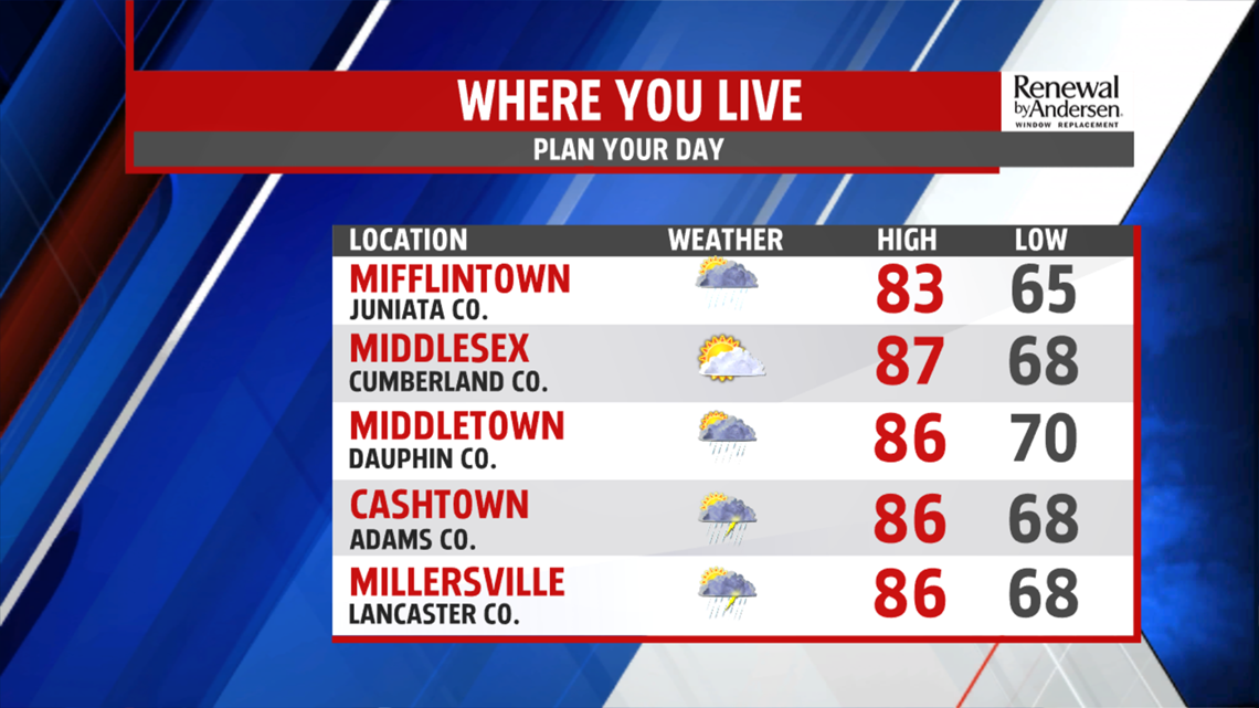
FINISHING THE WEEK: Conditions dry out through the morning commute. A few spotty showers can’t be ruled out in the early afternoon, keeping temperatures down a bit. Highs today reach the mid-to-upper 80s with Friday morning lows near 70-degrees. We start increasing the humidity Friday with mostly sunny skies and a high in the low-90s. Our heat index values will near the upper-90s.


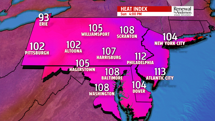
DANGEROUS HEAT THIS WEEKEND: Unless you’re poolside with plenty of water for yourself, you’re going to want to limit your outdoor time this weekend. Temperatures crank up to the mid-90s Saturday with heat index values between 100-105 degrees. We earn a couple extra degrees Sunday with highs just shy of 100-degrees. The heat index has the potential to rise about 105-degrees. This is not the weekend to do yard work. If you don’t stay hydrated, heat-related illness could occur.
NEXT THUNDERSTORM CHANCES: A minor disturbance next Monday brings us down to the mid-90s with a low thunderstorm chance. Our next best chance for thunderstorms comes next Tuesday, with the Fourth of July in sight at the end of the Weather Smart Forecast. We keep the low-90s through the middle of next week.
Have a great day!
-Meteorologist Bradon Long
