


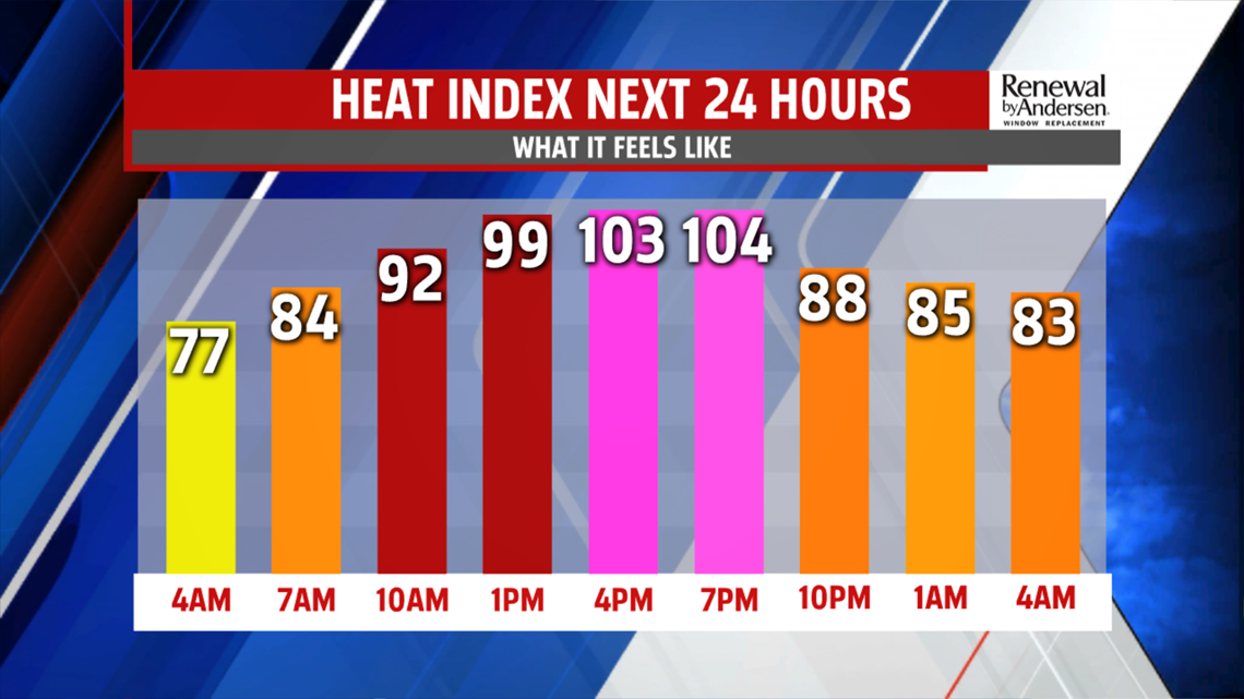
HEAT & HUMIDITY CONTINUE: The heat and humidity continue through the middle for the week, and Tuesday is no exception. It’s a warm and stuffy start with temperatures in the upper 60s to middle 70s for most. A few hazy spots start the day, but plenty of sunshine fizzles it fast after sunrise. Temperatures are back into the 90s during the afternoon under partly cloudy skies. Heat indices feel like 100 to 110 degrees once humidity is taken into account. Afternoon high temperatures reach the lower to middle 90s, perhaps a degree or two lower than yesterday for some. There’s a chance yet again for a couple stray thunderstorms, but many should manage to stay dry just like the previous day. The overnight period is warm and stuffy under partly cloudy skies. Some patchy areas of haze and fog form late. Temperatures fall into the lower to middle 70s.


4TH OF JULY FORECAST: The chance for showers and thunderstorms are up a bit more for the 4th, but there will still be plenty of dry time for any celebrations. Expect some isolated showers and thunderstorms during the afternoon. Temperatures are in the upper 80s to lower 90s, so some spots will break the streak of 90s. Other, not so much! Either way, it’s hot and humid, with heat indices in the 90s. Thursday is more of the same. Temperatures are in the upper 80s to lower 90s, and there’s a chance for a few thunderstorms. Heat indices are in the middle to upper 90s.

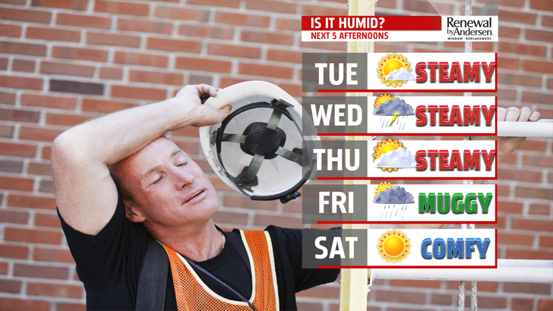
HEAT & HUMIDITY BREAKS FOR THE WEEKEND: The next system finally arrives Friday, and it breaks the heat and the humidity into the weekend. It’s brings the chance for showers and thunderstorms Friday afternoon, and we’ll have to monitor the severe weather potential. The system crosses through and is out of here by Saturday morning. Humidity levels plummet and there’s plenty of sunshine. Temperatures are in the upper 70s to lower 80s. Comfortable humidity levels remain in place for Sunday. There’s plenty of sunshine again too. Temperatures are in the lower to middle 80s. The abundant sunshine continues for Monday, but temperatures start to warm a bit. Expect readings in the middle to upper 80s. The humidity starts to creep up a touch too.
Have a great Tuesday!
