


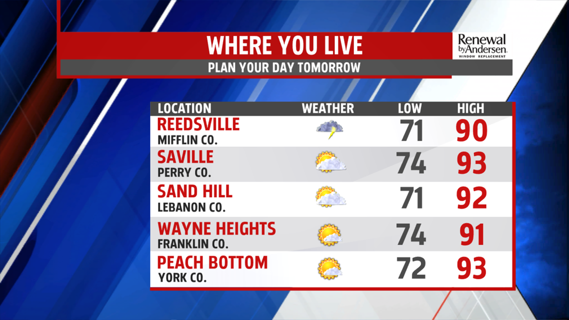
HUMID, A FEW STORMS: The cloud cover that stayed with us Sunday clears out for Monday. Highs reach the low-90s again, but we keep the humidity. Heat index values approach the 100-degree mark once again. A few storms will be possible in the afternoon and are not expected to be severe.


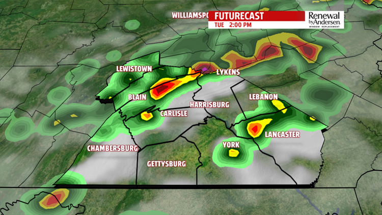
TUESDAY THUNDERSTORMS: Mostly cloudy skies keep temperatures in the upper-80s for Tuesday before a cold front passes through in the afternoon. Widespread showers and storms are likely in the mid-afternoon through the evening. These will be strong, but currently not expected to be severe. Heavy downpours, occasionally gusty winds and lightning will be common.
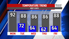

DRYING OUT, COOLER: After the cold front passes through, humidity levels lower with temperatures staying in the mid-to-upper 80s throughout the rest of the work week. Partly-to-mostly sunny skies with light winds will be the trend for a much nicer finish to the week.
Have a great one!
-Meteorologist Bradon Long
