


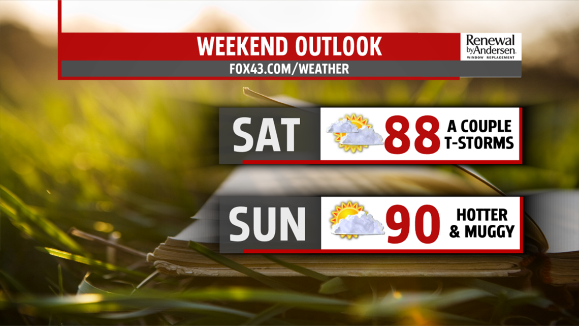
WEEKEND OUTLOOK: The weekend still brings some small thunderstorm chances, but it’s much drier for Central PA. It’s also warmer and a bit muggier. Saturday brings the chance for a couple isolated afternoon thunderstorms. Temperatures reach the middle to upper 80s. Sunday looks even drier, but a couple thunderstorms can’t be entirely ruled out. Readings are back into the upper 80s, but a few locations could flirt with 90 degrees. Heat indices feel like the lower 90s for many, with a steamy feel in place.
NEXT WEEK: Monday is hot and muggy. Temperatures are near 90 degrees again, and there’s the chance for a couple thunderstorms. Tuesday brings a better chance for showers and thunderstorms for the region. It’s very warm and steamy. Temperatures are in the middle to upper 80s. Wednesday brings the possibility for a few thunderstorms too, but this depends on the timing of the next system, so we’ll keep an eye on it. Thursday turns drier with plenty of sunshine. It’s a touch less warm, but the humidity remains in place.
Have a great weekend!
