


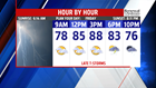


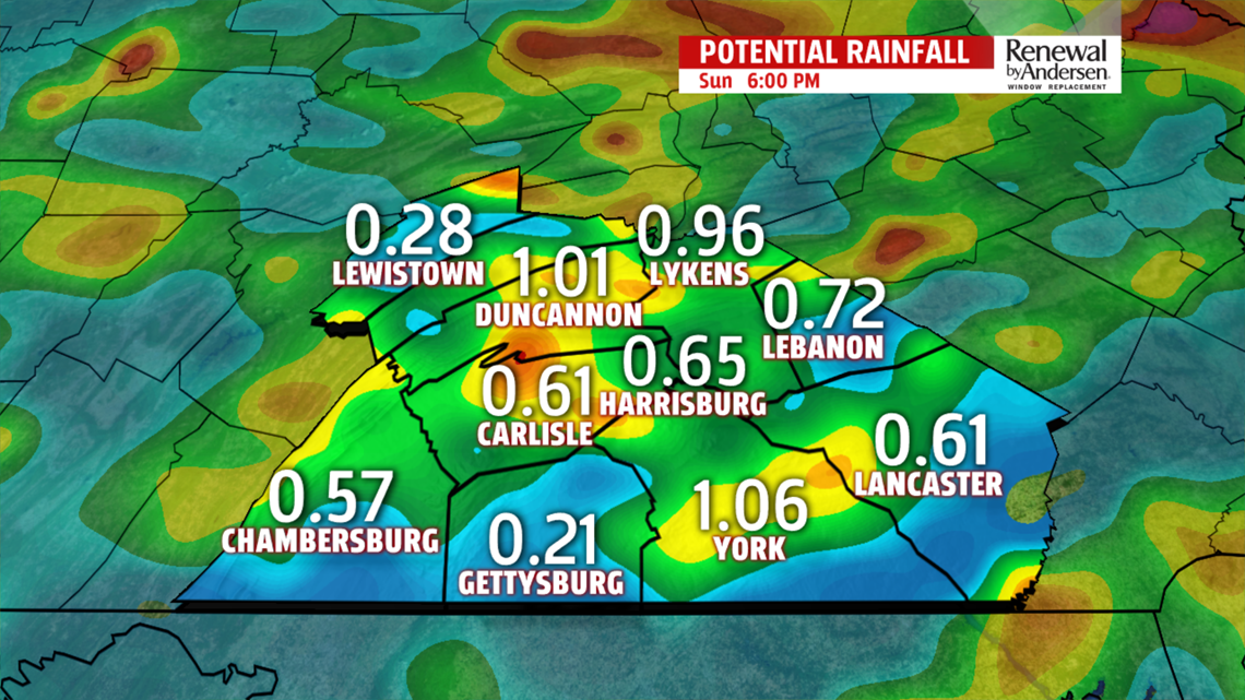
T-STORM CHANCES RETURN: The day starts dry, but shower and thunderstorm chances are expected to return for some on Friday. Skies are partly to mostly clear through the morning with a few hazy spots. Temperatures begin in the middle 60s to near 70 degrees and it feels humid too. Skies turn partly sunny to mostly cloudy through the afternoon. There’s the chance, especially north of Harrisburg, for a few showers, perhaps a couple thunderstorms. The best chance is later during the afternoon and into the early evening. Temperatures reach the middle to upper 80s. Be sure to remember the umbrella for any Friday evening plans! The overnight period is mostly cloudy with a couple showers still possible. Temperatures fall into the middle 60s to near 70 degrees.
UNSETTLED EARLY NEXT WEEK: The pattern shows some signs of give early next week, but drying out is going to be a sluggish process. Widespread showers and thunderstorms are looking very likely for Monday at the moment. We’ll have to monitor the potential for continuing flooding concerns. Otherwise, some showers and thunderstorms are still possible for Tuesday, but the coverage looks less widespread and more isolated. Temperatures both days are in the upper 70s to lower 80s depending on both cloud and rain coverage. The mugginess remains in place too. Wednesday dries out for the region. It’s very warm and humid, with temperatures in the middle to upper 80s. Some storm chances could return for Thursday.
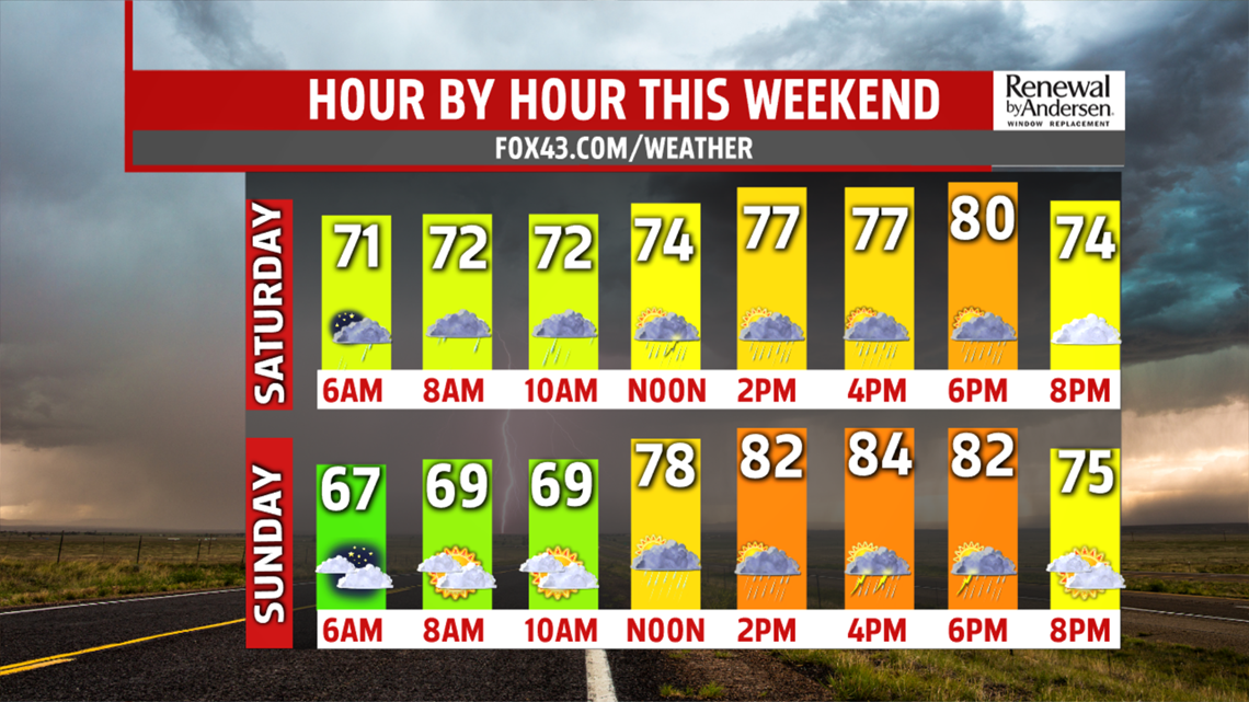
Have a great weekend!
