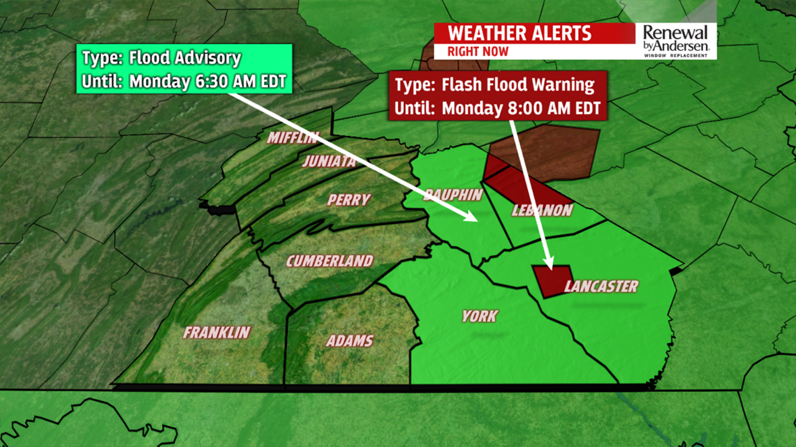

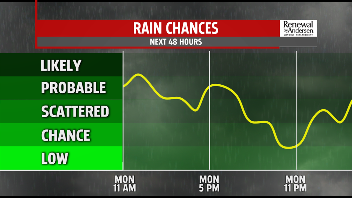
SHOWERS AND STORMS: A FLASH FLOOD WATCH is in effect for Dauphin, Lancaster, Lebanon and York counties until midnight Tuesday morning. Showers and storms this morning will put down a good deal of rainfall, 1-to-2 inches widespread in the watch area with locally higher totals possible. Showers and storms will continue off-and-on throughout your Monday with highs near 80-degrees. We get a break overnight before more showers and storms move into the area late in the morning into early Tuesday afternoon. The activity will be widespread, but not as intense as this morning. Highs make it to the low-80s after a muggy morning.


DRY WEDNESDAY: Showers and storms subside for Wednesday, giving us some much needed dry time. Highs jump as well, into the upper-80s. By Thursday, the chance for showers and storms return, a few of which, if they develop, could be strong. Highs near 90-degrees. Next weekend looks much cooler, staying in the low-to-mid 80s.