


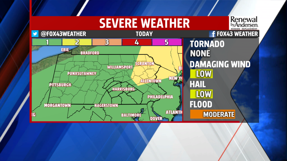


STORMS TODAY: A few morning showers yield to cloud cover for most of the day. That won’t stop temperatures rising into the upper-80s and low-90s once again. We have a low risk of severe storms this afternoon and evening, with the main threat being flash flooding. Small hail and gusty winds are lesser concerns. The more cloud cover we see, the less likely our storms are going to be severe. Showers and storms won’t end till late evening.
CONTINUING INTO THE WEEKEND: Showers continue into Saturday morning as we keep the cloud cover. Morning lows again hover on either side of the 70-degree mark. Morning showers will be few and far between, but more come up into the afternoon and evening. Severe weather is not currently expected on Saturday. Highs stay in the low-to-mid 70s.


DRYING OUT: We dry out heading into Sunday with much less humidity and lower temperatures. Mostly cloudy skies dominate with highs near 80-degrees. We stay dry to start the work week, but with higher humidity values again for Monday and highs in the mid-80s. Rain chances return heading into Tuesday.
Have a great day!
-Meteorologist Bradon Long
