

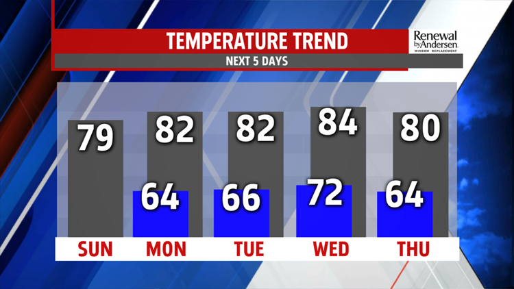

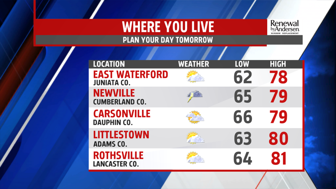
A LOT COOLER: After Saturday’s showers and storms, the cool front pushes through with cloud cover sticking around for Sunday. Morning lows drop into the mid-60s with mostly cloudy skies dominating the day. Highs struggle to hit 80-degrees, but most locations stay in the upper-70s. A stray shower will be possible, but most locations stay dry to finish the weekend. Morning lows dip a little more into the low-to-mid 60s Monday morning as clouds begin to clear. High temperatures jump into the low-80s with mostly sunny and dry skies.

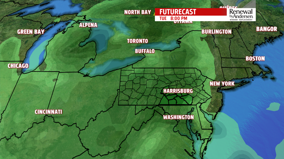
STORM CHANCES RETURN: Temperatures stay in the low-80s Tuesday afternoon, but showers and storms return widespread. A few could be strong under otherwise mostly cloudy skies. Showers continue off-and-on into Wednesday morning. Drying out with lows in the low-70s, partly cloudy skies return by the afternoon with highs in the mid-80s.


FINISHING NEXT WEEK: Temperatures stay below average with morning lows in the low-60s Thursday morning. Even with abundant sunshine, northwest winds bring in cooler air behind the mid-week storm system and keep highs near 80-degrees. We stay dry heading into the weekend with highs in the mid-80s.
Have a great one!
-Meteorologist Bradon Long
