


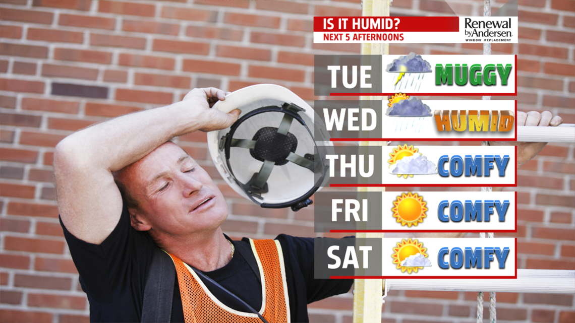
Then abroad area of high pressure builds in for a few days finally bringing a string of much needed dry days. High temperatures Tuesday are in the upper 70s to near 80 then warm to the lower 80s Wednesday. Nice comfortable, less humid conditions expected Thursday with morning lows near 60 degrees and afternoon highs in the upper 70s to near 80 degrees. A very comfortable, cool morning in the 50s begins our Friday. Under bright skies and plenty of sunshine, temperatures recover nicely into the lower 80s.
WEEKEND OUTLOOK: High pressure begins to move east setting up a return flow. With the southwesterly breeze, the humidity increases and temperatures are warmer. However, it’s another great start to the day with morning lows in the 50s. A little more cloud cover Saturday but still plenty of sunshine to boost temperatures into the lower and middle 80s. Partly cloudy and dry for Sunday but late in the evening, a frontal boundary drops into our northern counties and may trigger a stray shower or two. It’s warmer and more humid in the middle and upper 80s. Depending on where the front ends up, a few showers or thunderstorms could develop Monday, otherwise, it is very warm and muggy under partly sunny skies.
The FOX43 Weather Team is keeping you “Weather Smart” 7 days a week!
Have a good day!
MaryEllen Pann,
Chief Meteorologist
