
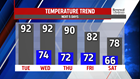
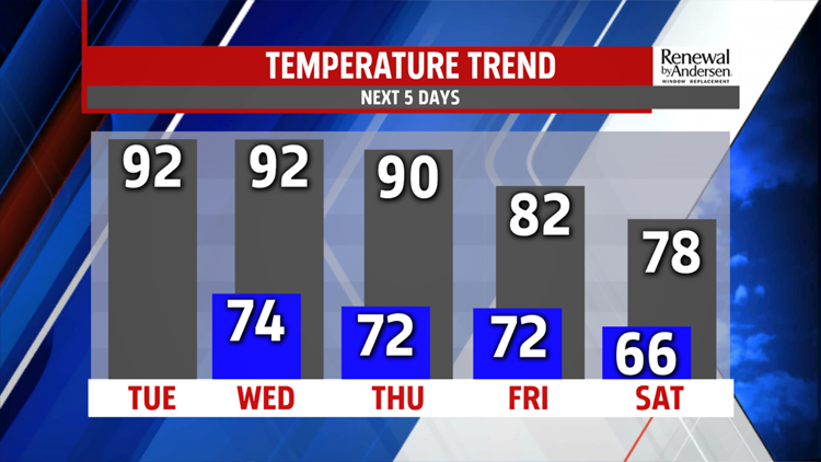
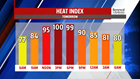
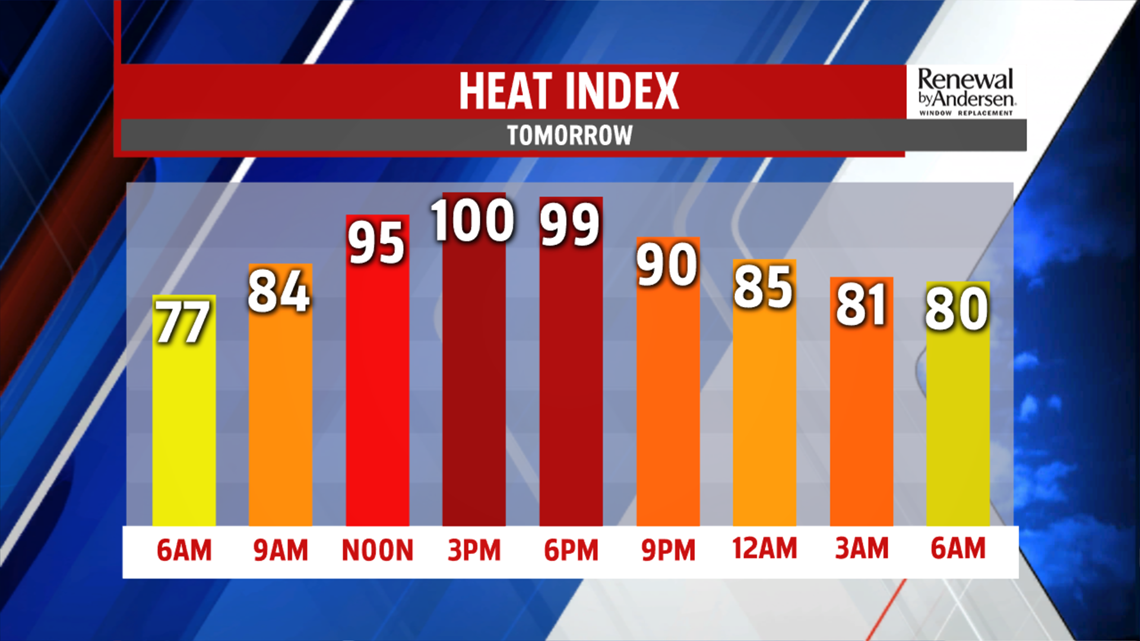
HEAT CONTINUES: Temperatures stay in the 80s for much of Monday evening. The muggy feel stays with us overnight and into the morning. Lows dip into the mid-70s again with patchy fog. A stray afternoon thunderstorm can’t be ruled out in the afternoon with high temperatures in the low-to-mid 90s. Heat index values will approach the 100-to-105 degree range again in the afternoon under partly cloudy skies. This could cause health problems if you’re not careful, so limit your outdoor time and make sure to stay hydrated. Wednesday is a near exact copy of Tuesday, but with just a little bit more sunshine.


STORMS THIS WEEK: After a muggy morning start in the low-70s for Thursday, showers and storms are possible Thursday afternoon. Highs near 90 bring heat index values into the mid-90s before the rain chance. However, not everyone will see rain as our cool front pushes through. It stalls out to our south into Friday. Depending just how far it pushes south of the Mason-Dixon, shower chances could return into our area Friday with highs in the low-80s. The highest rain chances would be for our southern counties, but with continued forecast model inconsistency, stay tuned for updates heading into the weekend.

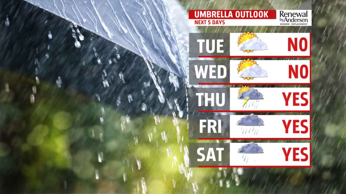
HEADING INTO THE WEEKEND: A similar situation evolves for Saturday and Sunday. What is for certain, temperatures will be cooler. Many locations don’t make it out of the 70s all weekend long with mostly cloudy skies. Our rain chances are limited for now, but a few showers possible both weekend days. However, the further south the stalled-out front pushes, the lower the rain chances. The more northerly path brings much higher rain chances and flooding concerns into our area, especially with a still-saturated ground. We’ll be watching this closely for several days, so stay with us to prepare so we can keep you “Weather Smart.”
Have a great one!
-Meteorologist Bradon Long
