


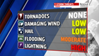

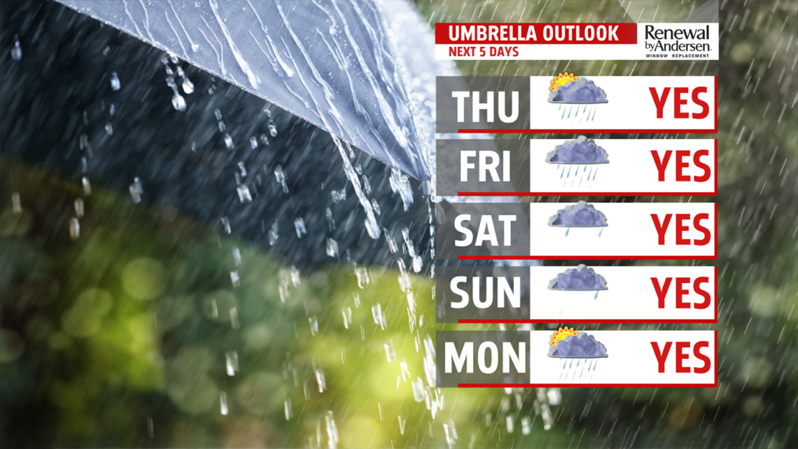
UNSETTLED WEEKEND OUTLOOK: We break the heat moving into the weekend, but it comes at a price. That price with be shower activity as we watch an unsettled pattern set up. Friday is mainly cloudy and brings the chance for some afternoon showers and thunderstorms. Some locally heavy downpours are a potential. Temperatures fall back into the upper 70s to lower 80s. The setup remains dreary for Saturday. Some on-and-off showers are possible. It’s not a washout, so there should be some drier periods. Expect temperatures in the upper 60s to lower 70s. Sunday still brings the chance for showers, and it remains on the cool side. Temperatures are near 70 degrees.
NEXT WEEK: Monday brings a little drying, but more than likely, some shower and thunderstorm chances remain. It’s muggy, with temperatures in the 70s to near 80 degrees. This will depend on shower coverage, however. The pattern remains sluggish into Tuesday, so the thunderstorm chances remain. Temperatures should be warmer, with readings in the upper 70s to lower 80s. A couple isolated thunderstorms are still possible for Wednesday. It’s warm and stuffy, with readings back into the upper 70s to lower 80s.
Have a great Thursday!
