


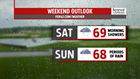

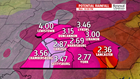
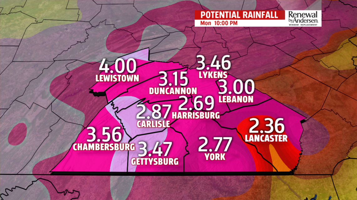
COOLER AND RAINY, FLOODING: Temperatures fall through the 80s and back into the 70s throughout the evening. Scattered showers are likely across the area, which will make many football games a wet go this evening. Morning lows dip into the upper-50s and low-60s. Showers continue overnight and into the morning, especially along the Mason-Dixon. High temperatures struggle to rise with dense cloud cover throughout the day. Many locations won’t leave the 60s, while a few may inch into the low-70s. Widespread showers move in off-and-on overnight Saturday and last for most of the day Sunday. Flooding is a clear concern ending the weekend as several inches of rainfall will be possible. We’ll continue to monitor the situation and bring you the latest updates as they come available.
NEXT WEEK: We keep the chance for a few showers and storms to start the week. Highs creep up into the mid-70s with a few afternoon showers possible Monday. We get to the low-80s by Tuesday with a similar chance for afternoon thunderstorms. They will be few and far between. Morning lows jump from upper-50s on Monday to the upper-60s for Tuesday as skies remain mostly cloudy. Sunshine peaks back out by Wednesday with highs in the mid-80s.

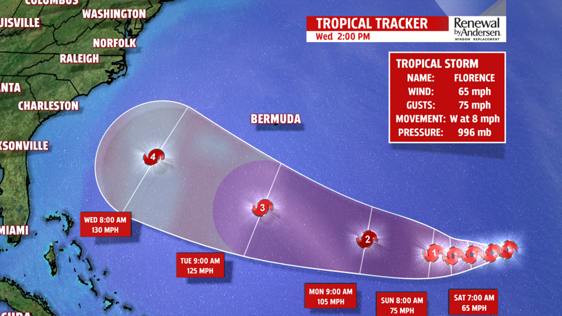
MONITORING FLORENCE: As of 2:30PM, Florence is still a tropical storm several days off the coast of the United States. However, increasing model agreement does pose a potential threat for the East Coast. Florence is expected to strengthen over the next five days and could regain major hurricane strength. Beyond the forecast track, models differ, as always, upon potential path to landfall. However, both the American and European model ensembles bring Florence to the East Coast by the middle of next week. This is still very much in the air. Much is still to be debated as we get closer to time. The potential impacts that Florence could have on Central PA are unclear, but impacts are possible. Let’s get through our flash flooding Sunday. Then our eyes will turn to Florence with a much more certain forecast on what to expect in the next few days. Until then, stay dry this weekend and keep tuned for the latest updates to stay “Weather Smart!”
Have a great one!
-Meteorologist Bradon Long
