

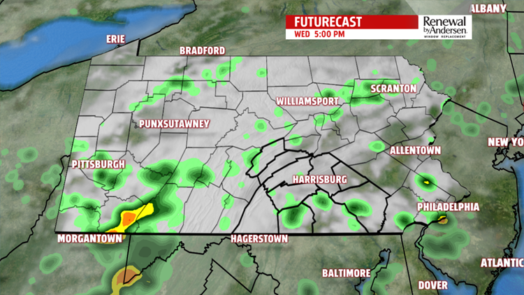


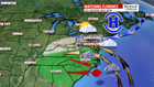
STALLED PATTERN/MORE SHOWER CHANCES: The setup remains stalled through the end of the week. This means there’s the chance for a couple showers, and that’s how Wednesday morning begins. There’s plenty of clouds, in addition to a few hazy and foggy spots. Temperatures begin in the 60s. The clouds and dull conditions keep temperatures in the 70s through the afternoon. It feels muggy too. There’s a few more additional isolated showers, perhaps a thunderstorm. Although the brunt of any isolated shower activity should be light to moderate, a heavier downpour is possible. This makes for a small chance for additional flooding in an isolated spot or two. However, no widespread issues are expected today. The overnight period brings more clouds, mild temperatures, muggy conditions, and some areas of haze and fog. Lows fall back into the middle to upper 60s. Thursday brings more of the same. Expect the clouds, perhaps a few limited breaks of sunshine, and the chance for a few showers or thunderstorms. Temperatures reach the middle to upper 70s. We watch the track of Hurricane Florence as it approaches land near the Carolinas. A strengthening area of high pressure north of the region interacts with the flow around Florence, and for us, this means an east flow begins to set up Thursday night into Friday as the system slowly drifts inland. It will be well south of us, but the east flow brings a cloud deck and the chance for some light showers and drizzly pockets. Temperatures are stuck in the 70s.

WEEKEND OUTLOOK: Track changes in Florence are sparing the weekend from direct influences from Florence. However, indirect influence in the form of that pesky east flow continues. This means plenty of clouds throughout the weekend, unless Florence ends up tracking a little more south. Some light showers and drizzly pockets are possible too. The dreary conditions keep temperatures in the lower to middle 70s depending ultimately on how the cloud cover and shower activity pans out.
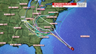

NEXT WEEK: With the new track changes for Florence, the chances of direct impacts in the form of rain have been pushed back to early next week. However, there is still a lot of uncertainty on how much rain, if any Central PA sees. With that said, we are now watching the Monday to Tuesday timeframe for potential rainfall related to Florence’s remnants. Much can still change at this time, so check back frequently through the weekend for updates and potential changes. Rain would keep temperatures in the 70s, and flooding concerns are not out of the question. For now, we continue to wait in order to fine tune those specifics for you.
Have a great Wednesday!
