


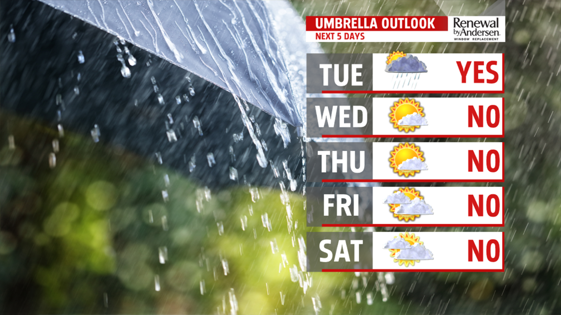
DRY MIDWEEK: A nice treat in the form of dry conditions is ahead for the middle of the week. Wednesday brings plenty of sunshine to dry the region after Florence’s remnants exit. It’s still muggy, with temperatures in the upper 70s to lower 80s. It’s more of the same for Thursday. Expect temperatures in the lower 80s. It’s still warm and stuffy. Friday is dry to start, but clouds increase ahead of the next cold front. Temperatures reach the lower to middle 80s. There’s a chance for a couple late day or evening showers, perhaps a thunderstorm.
WEEKEND OUTLOOK: We’ll be monitoring rain chances into the weekend. Friday’s front stalls nearby, and the location of this will dictate shower chances for the weekend. For now, it appears only a couple morning showers are possible for Saturday, with drier conditions and some sunshine breaking out for the afternoon. Temperatures are in the upper 70s to near 80 degrees. Don’t forget, it’s also the first day of fall! Sunday brings more rain chance to the region depending on the positioning of the front. Expect temperatures in the 70s. Monday brings a small chance for showers. Temperatures are in the 70s.
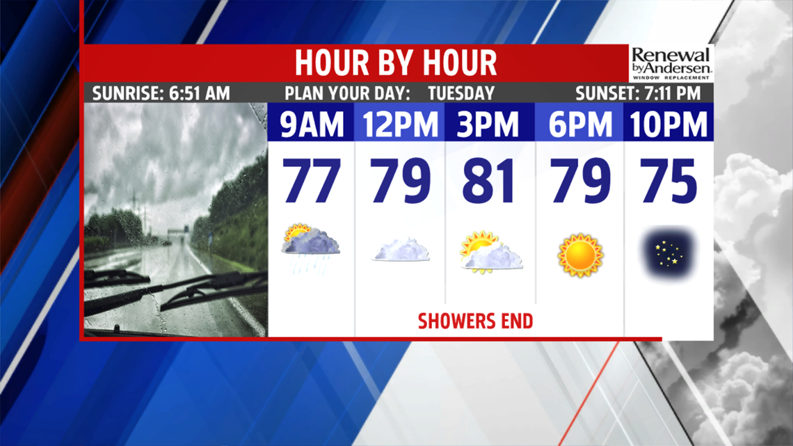
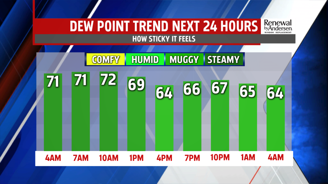
Have a great Tuesday!
