


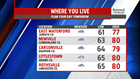
HEADING INTO WEDNESDAY: Temperatures hold in the 60s throughout the evening with mostly cloudy conditions. A few isolated light showers remain possible throughout the night, but most locations avoid them. Patchy fog and cloud cover sticks around with morning lows staying in the 60s for the most part. Temperatures tomorrow are warmer with some afternoon breaks in the clouds. Highs just shy of 80-degree will be the norm with late afternoon and evening thunderstorms likely area-wide.
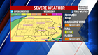
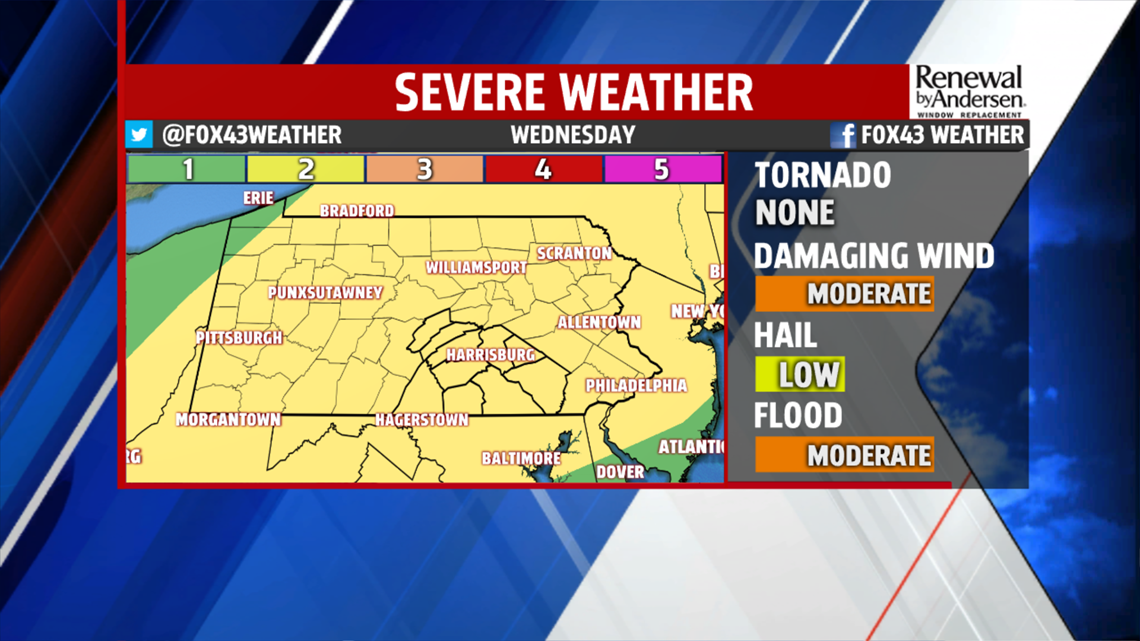

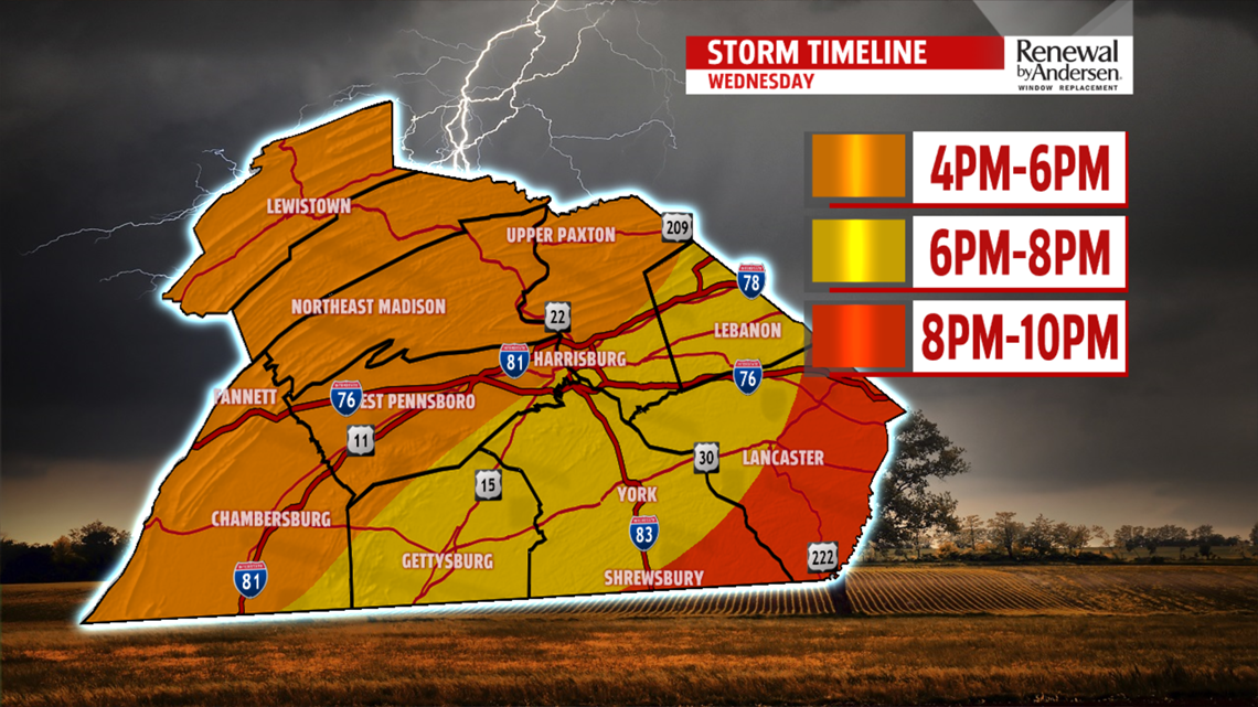
SEVERE WEATHER THREAT: A cold front pushing through sparks thunderstorms in the western and northwestern portions of the Commonwealth in the early afternoon. If we have more cloud cover and drizzle in the morning, the lower our severe threat. However, a bit of dry time with less heavy cloud cover looks likely ahead of our thunderstorm chances. On a scale of 1-to-5 for severe weather, we’re at a 2. Flash flooding is the big concern, with damaging winds over 60+MPH and small hail possible as well. The tornado threat is extremely low. Storms move through our area beginning in the farthest northwest counties from 4PM and progress through the area throughout the evening, ending by around 9PM in the southeastern areas. Overall rain totals won’t be exceptionally high, however torrential brief downpours will be possible in the strongest storms.
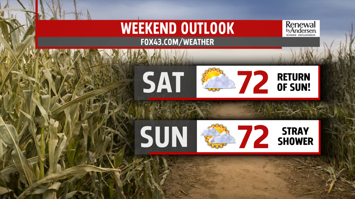
FINISHING THE WEEK: The effects of the cool front felt Thursday bring temperatures back down into the low-50s for the morning and mid-to-upper 60s by the afternoon under partly cloudy skies. A small rain chance sneaks in Friday morning as highs stick in the low-70s. Sunday has the potential to be significantly cooler with morning lows in the upper-40s in some spots for the first time in the season. High temperatures at or just shy of 70 will be the tune to finish out the weekend.
Have a great one!
-Meteorologist Bradon Long
