


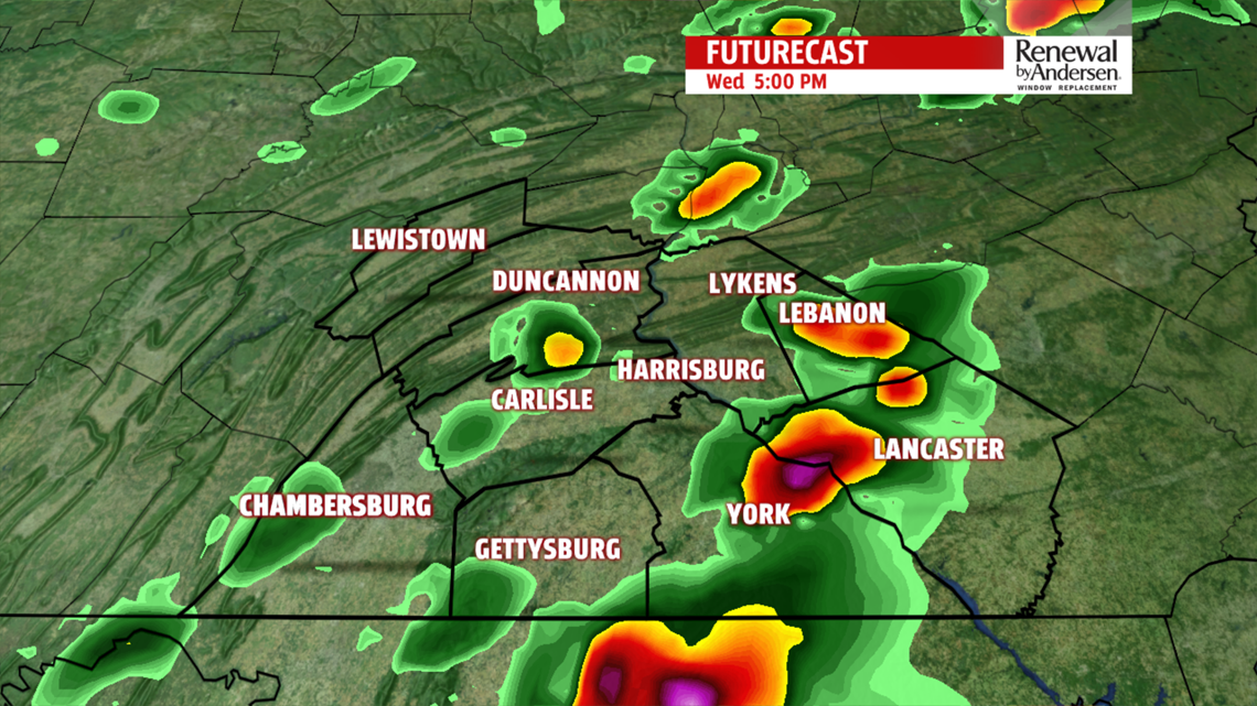

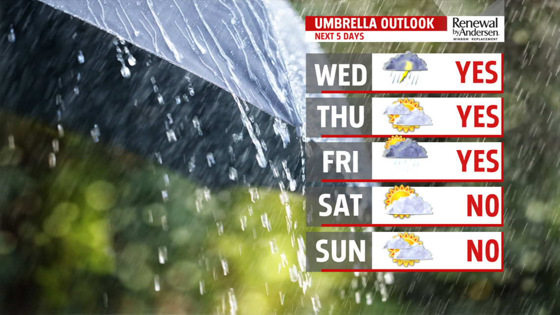
DRIER END TO THE WEEK: The end of the week is much drier, but some small shower chances linger. Wednesday’s front stalls to the south, so we’re going to have to keep an eye on it for more showers. For now, Thursday should be dry, but we can’t rule out the chance for a shower or two. Temperatures are cool due to the clouds, with readings in the middle to upper 60s. There’s indication a wave rides along the front and could brings some light showers Thursday night into Friday. A few showers linger into Friday during the morning. The afternoon should dry out as long as the front doesn’t pull any tricks. Skie are partly sunny for the second half of the day. Temperatures are a touch higher, with readings in the lower 70s.
WEEKEND OUTLOOK: The weekend doesn’t look bad at all to start! Saturday brings partly cloudy skies and quiet conditions. Temperatures reach the lower to middle 70s. Sunday our next cold front crosses through, and this could bring a few light showers to the region. Temperatures reach the upper 60s to lower 70s depending upon the timing and the coverage of the shower activity. Monday is partly sunny and a bit cooler. Expect readings in the upper 60s to lower 70s. Tuesday is warmer and partly cloudy. Expect temperatures in the middle 70s to near 80 degrees.
Have a great Wednesday!
