

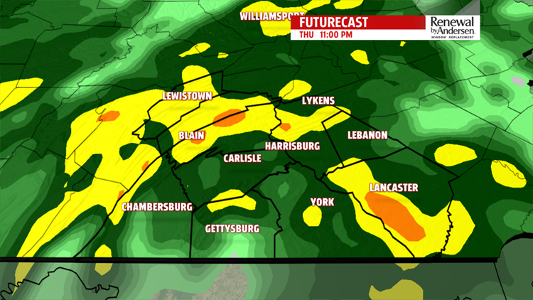


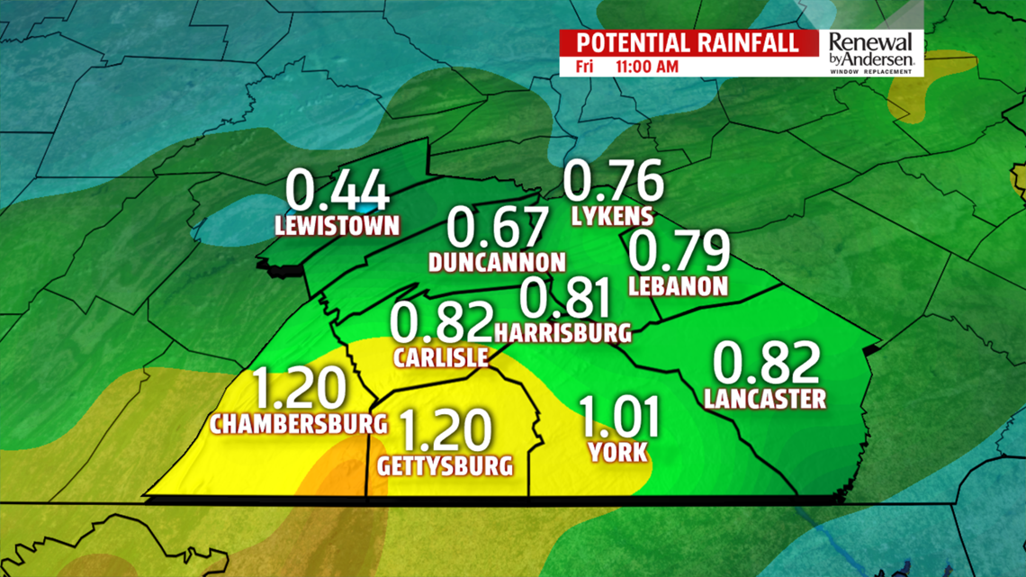
OVERNIGHT AND FRIDAY MORNING: Showers moving in from the southwest increase in intensity and number throughout the evening and into the overnight hours. A FLOOD WATCH is in effect for Adams, Lancaster and York counties until 8AM Friday morning. Temperatures drop through the 60s and into the upper-50s. Rain continues throughout much of the morning before sunrise. Morning lows dip into the mid-50s. Rain ends as the sun rises over the area with a few stragglers through mid-morning. Widespread totals near an inch are likely.


DRYING WEEKEND: Skies clear throughout the day with some sunshine peeking through in the mid-afternoon and continuing throughout the rest of the day. Highs reach the mid-70s area-wide. Similar conditions head our way Saturday and into Sunday. Morning lows in the 50s and highs in the low-70s become the norm Saturday and Sunday for a relatively pleasant weekend.
HEADING INTO NEXT WEEK: Temperatures warm to the 80-degree mark Monday with increasing humidity as well. Isolated thunderstorm chances return Tuesday and Wednesday with morning lows in the low-60s, highs in the low-80s. Our next storm system could head our way by next Thursday. Stay tuned for updates to the Weather Smart Forecast.
Have a great one!
-Meteorologist Bradon Long
