


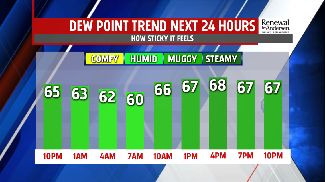
HEADING INTO TOMORROW: Temperatures hold onto the 70s into the evening. Overnight lows dip once again into the 60s under partly cloudy skies. Muggy dew points remain the norm, allowing for patchy morning fog and reduced visibility once again. Skies remain partly-to-mostly cloudy throughout Tuesday with highs just above the 80-degree mark in most spots ahead of the low severe weather threat.

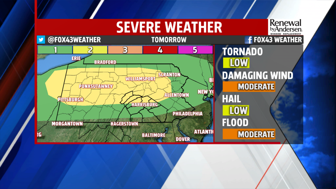
TUESDAY SEVERE THREAT: On a scale of 1-to-5, our farthest northern areas are at a 2, while the rest of the area is at a 1. Our main concern will be gusty winds with storms that push through. Localized flash flooding due to pockets of heavy rainfall, as always, will be a concern along with small hail. The main threat is throughout the late afternoon and into the evening. There is a very low tornado threat. Storms end heading into the overnight hours.

LOW STORM CHANCES, WARMER WORK WEEK: We keep the thunderstorm chances low, but present, Thursday evening into Friday morning. Highs raise further into the 80s by Thursday with morning lows continuing in the low-to-mid 60s. Isolated thunderstorms remain Friday into Saturday as temperatures drop into the 70s heading into the weekend.
Have a great one!
-Meteorologist Bradon Long
