


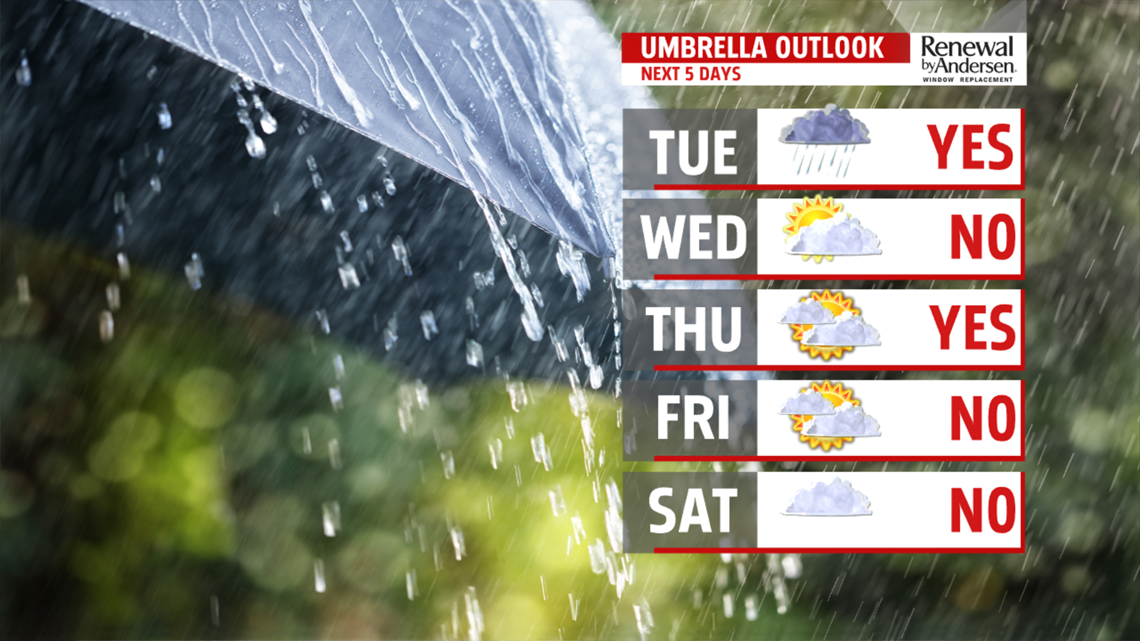
STILL WARM THROUGH MIDWEEK: The ridge of high pressure quickly builds back Wednesday as this next ripple exits the area. Skies are partly cloudy for Wednesday. Temperatures should be able to bounce right back into the lower 80s. It’s still on the muggy side too. Thursday is the warmest day this week ahead of the next cold front. There’s the chance for a couple late day thunderstorms, but the best chance is going to be during the evening hours. Temperatures reach the lower to middle 80s! We cool back down Friday, and humid levels come down a bit also. There’s plenty of clouds and a small chance for an isolated shower. Temperatures reach the lower 70s.
WEEKEND OUTLOOK: A front hangs nearby into the upcoming weekend, so we’ll have to monitor the positioning of the front for shower chances and temperatures. Saturday should bring plenty of clouds and a small chance for some isolated showers. Temperatures are in the upper 60s to lower 70s. We should be a bit more on the warm side of the front on Sunday, but the chance for an isolated thunderstorm remains. Temperatures are in the upper 70s to near 80 degrees. Monday remains warm and humid. Skies are partly cloudy, with temperatures near 80 degrees again. There’s a tiny chance for a stray pop up thunderstorm.
Have a great Tuesday!
