


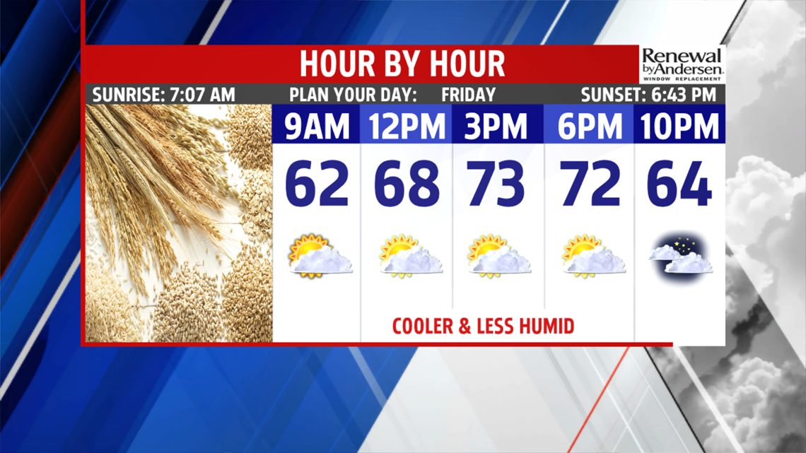

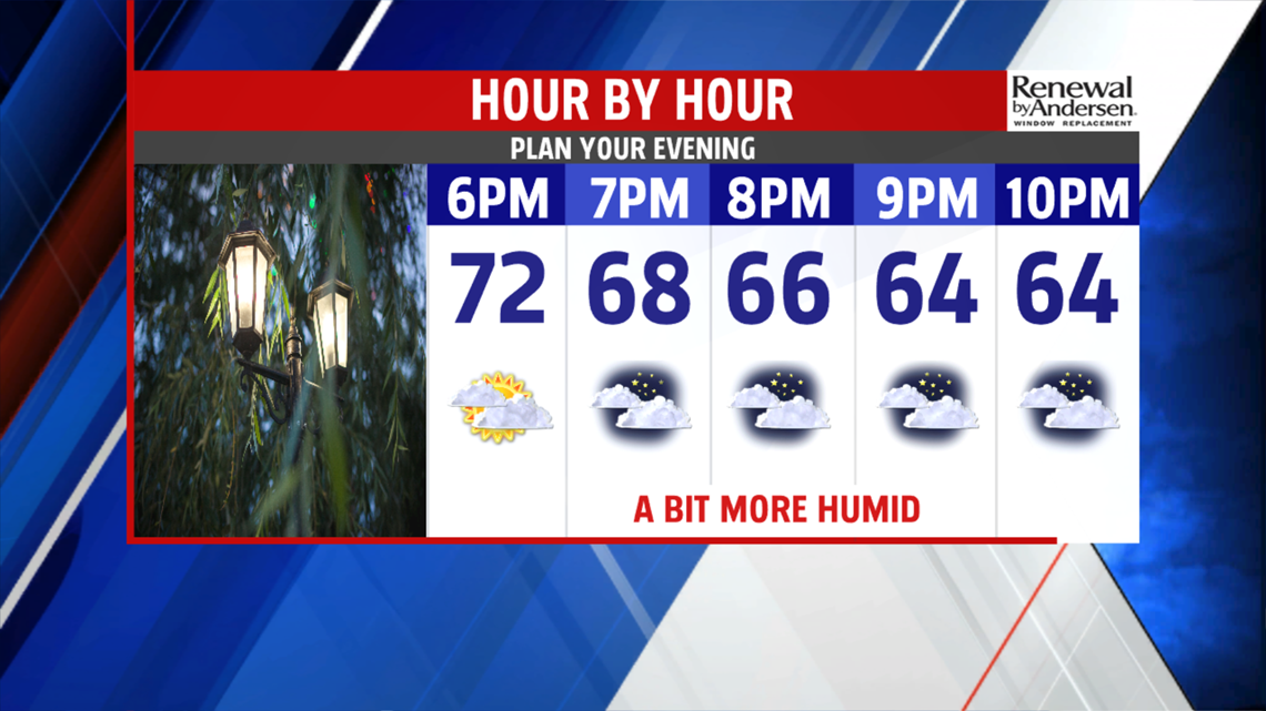
COOLER/LESS HUMID/NICE: Skies to continue to clear this morning, and humidity levels drop ahead of what’s going to be quite the pleasant Friday. Temperatures begin lower too, with readings beginning in the upper 50s to lower 60s. Skies are partly cloudy to partly sunny through the rest of Friday. The humidity levels remain lower too. Temperatures reach the upper 60s to lower 70s during the afternoon. Believe it or not, this is still a bit on the mild side for this time of year. Regardless, not a bad day at all, and conditions for Friday evening plans look good to go as well. The overnight period is cool, and it becomes a bit more humid. Lows fall into the upper 50s to near 60 degrees under mostly cloudy skies as a warm front approaches. Some patchy areas of fog and haze are possible late, even a drizzly spot or a shower near daybreak.


WEEKEND OUTLOOK: A front hangs nearby into the upcoming weekend, so we’ll have to monitor the positioning of the front for small shower chances and a shift in temperatures. Saturday should bring plenty of clouds to start as a warm front lifts north. An early morning shower or some drizzly spots are possible, but clouds should start to break during the afternoon. Temperatures are in the upper 60s to lower 70s. We should be on the warm side of the front on Sunday, but the chance for an isolated thunderstorm remains, especially if it’s a little closer to us. Temperatures are in the upper 70s to near 80 degrees. The humidity starts to increase again and turn even muggier.

WARM AGAIN NEXT WEEK: The warmth continues building back into the region through the early half of next week. Monday is no exception, and it remains warm and stuffy. Skies are partly cloudy, with temperatures near 80 degrees again. There’s a tiny chance for a stray pop up thunderstorm. Tuesday pushes the warmth even higher above seasonal averages for this time of year! Skies are partly cloudy, with readings in the lower to middle 80s. The humidity levels remain high. It’s more unseasonable warmth and humidity for this time of year on Wednesday. Temperatures remain in the 80s under partly sunny skies. By Thursday, the next cold front arrives, and this brings the chance for showers and thunderstorms, particularly during the afternoon and evening. Temperatures reach the upper 70s to near 80 degrees.
Have a great weekend!
