


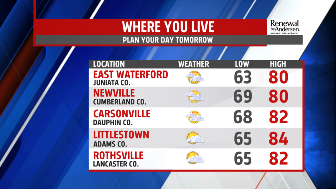
JUST PLAIN STUFFY: Temperatures continue into the 80s as we head into the evening. Dew points well into the 60s and low 70s remain the norm, keeping our egregiously muggy feel throughout the night. Morning lows in the upper-60s area-wide leave the likelihood of morning fog once again. Highs tomorrow are similar to today, low-80s for most under partly-to-mostly cloudy skies. Wednesday shapes up similarly with highs near 80-degrees and morning lows in the mid-60s ahead of our next significant rain maker – the remnants of Hurricane Michael.


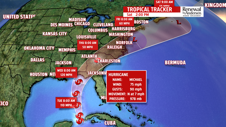
RAIN CHANCES: The path of Hurricane Michael vastly influences the amount of rainfall we see late Wednesday and for the entire day on Thursday. The current track takes the storm to our south and east, which would leave a decent amount of rainfall throughout the day Thursday. Most importantly, it’s rain we don’t need. Flooding will be a concern. We’ll keep you up-to-date with the latest forecast tracks from the National Hurricane Center and with our forecasted effects for Central PA to keep you “Weather Smart!”

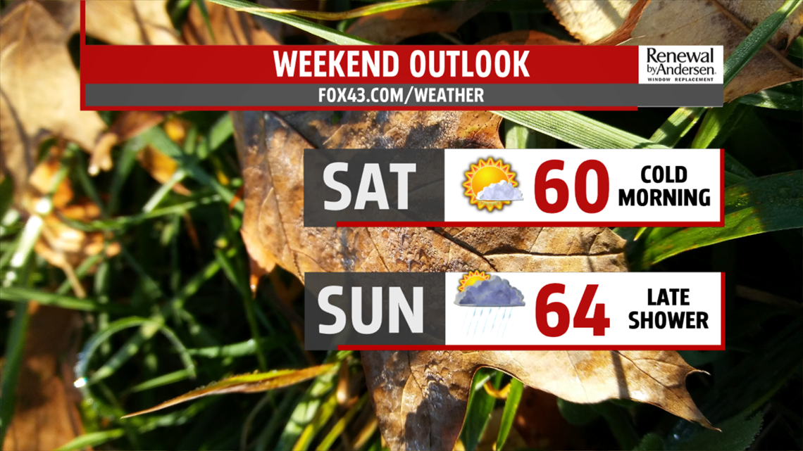
AUTUMN APPEARS: Once the storm passes, Autumn finally arrives in full swing. Friday afternoon temperatures don’t leave the mid-60s under partly cloudy, slightly breezy, skies. Morning lows Friday dip into the low-40s, a cold punch for most of us. Highs fall right to the 60-degree mark. Highs stay in the 60s all weekend long and into next week.
Have a great one!
-Meteorologist Bradon Long
