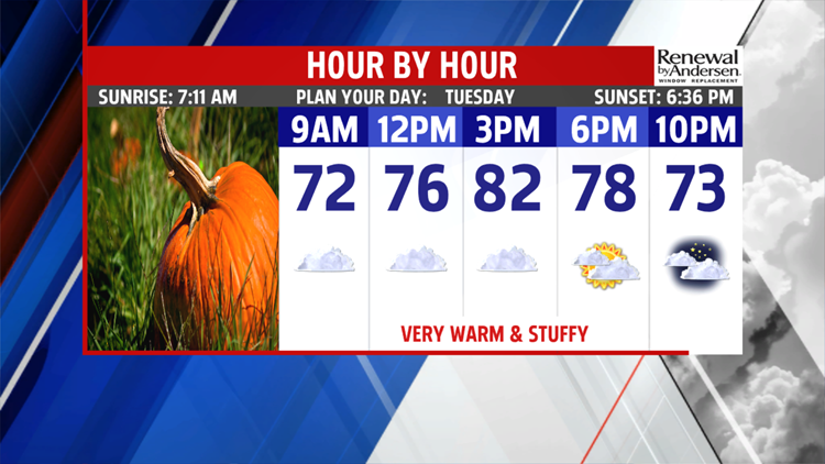

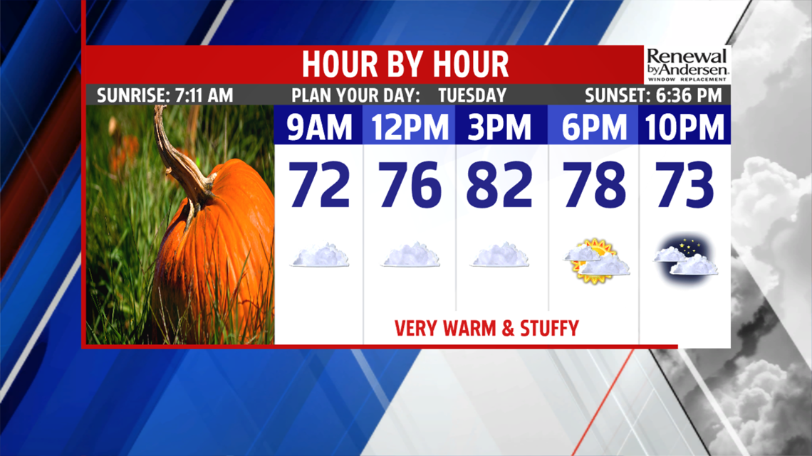

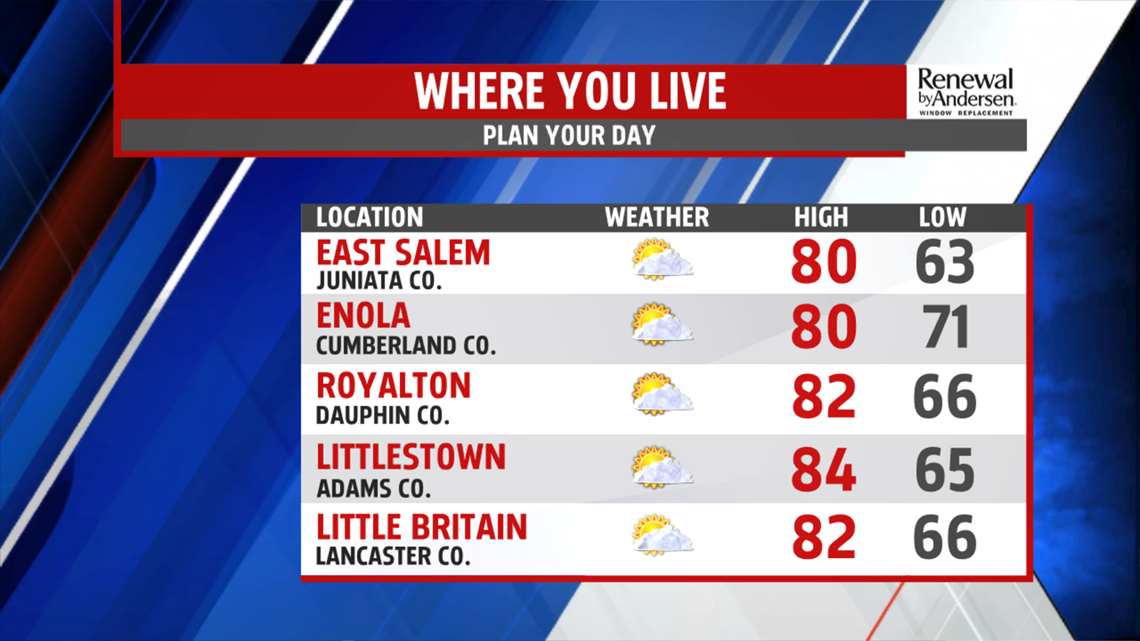
WARM & STUFFY CONDITIONS CONTINUE: Tuesday starts quite similar to Monday in many ways. More hazy, foggy, and even drizzly spots begin the day. Temperatures are warm and stuffy, with readings in the 60s to near 70 degrees. There’s a small chance for a stray shower. The rest of Tuesday brings more unseasonable warmth for this time of year. More sunshine sneaks out throughout the region, and it helps boost afternoon temperatures back into the upper 70s to lower 80s. The humidity levels remain abnormally high for this time of year too. Through the night, expect more of the same with the fog, haze and drizzle. Overnight lows fall into the 60s to lower 70s. It’s more unseasonable warmth and humidity for this time of year on Wednesday. Clouds build ahead of the next cold front. Also, moisture streams in from the Atlantic as we watch this front’s interaction with Michael as it gets pulled inland and through the SE US. This keeps plenty of clouds in place, but it could also bring a few light showers before the day is done. Temperatures are in the 70s to near 80 degrees. Showers fill in fast Wednesday evening and becomes a steady rain overnight for many.


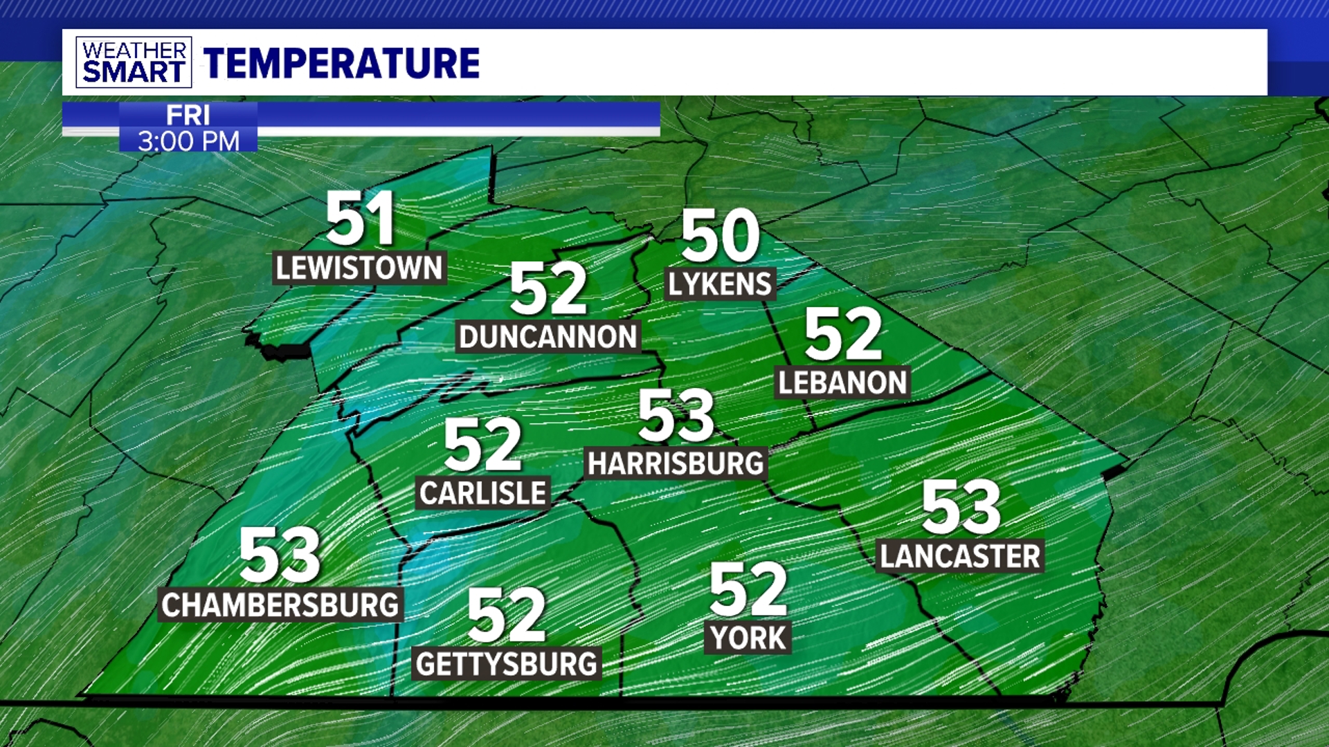
BREAKING THE WARMTH: By Thursday, the next cold front crosses through, and it’s a potent one. It also brings some added moisture associated with Michael, so the day looks like quite the soaker. We miss the brunt of the remnant moisture, but we’ll have to watch for some potential minor flooding in a few locations. Temperatures reach the middle 70s. In the wake of the front, less humid and cooler—yes, cooler air works into the region! Skies are partly sunny for Friday. Temperatures are in the upper 50s to lower 60s with a bit of a breeze. Finally, the crisp and cool feel of fall missing so far for October arrives!

COOLER WEEKEND OUTLOOK: The weekend continues the return to the fall feel that’s been lacking for much of the month! Saturday brings a good amount of sunshine and cool temperatures. Readings are in the upper 50s to lower 60s. The next chance for showers is Sunday depending on the timing of the next cold front. Temperatures are in the upper 50s to lower 60s. If the timing ends up a little slower, expect that chance on Monday instead. As of this morning, models are beginning to lean more toward Monday. Temperatures on Monday are a little higher in the 60s.
Have a great Tuesday!