


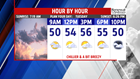
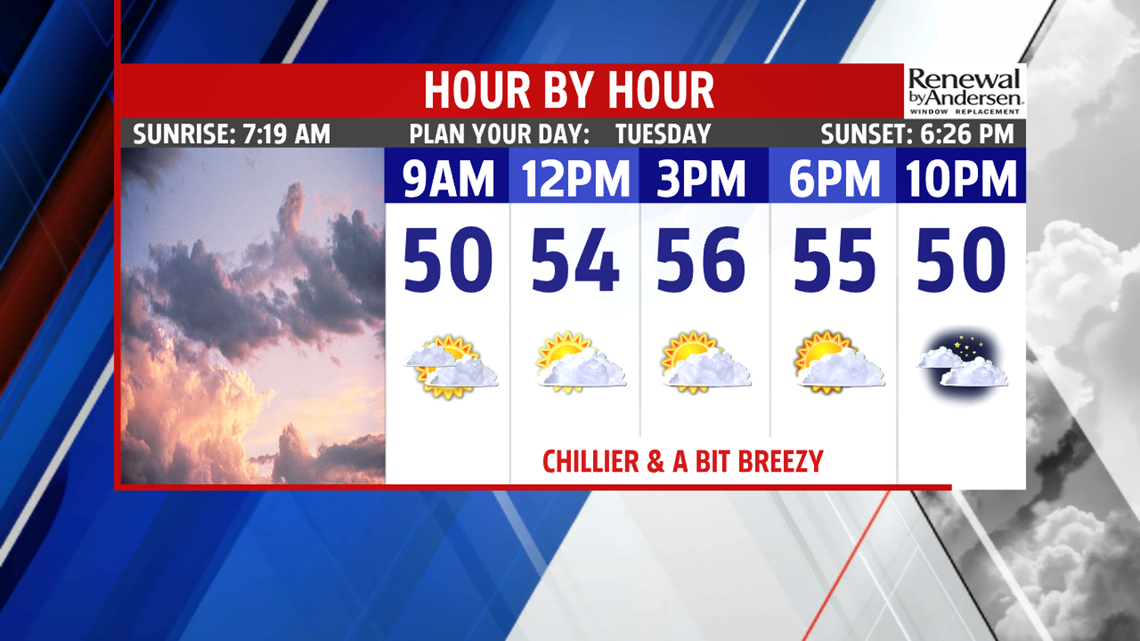

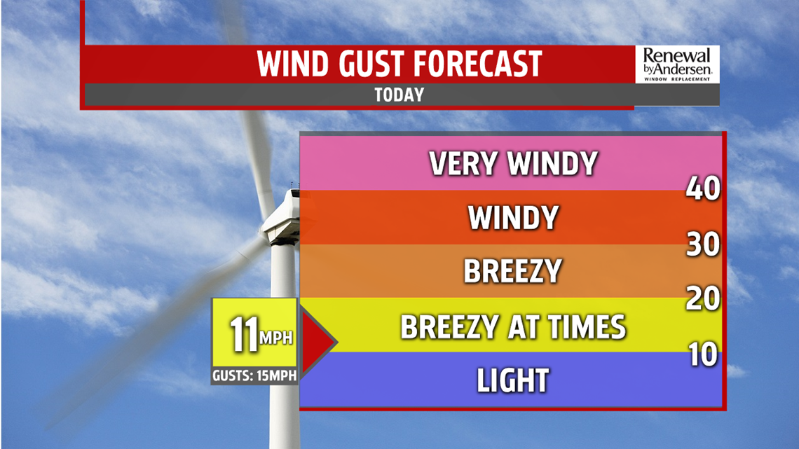
TURNING CHILLIER AGAIN: Conditions have partially cleared across the region, but it’s back to some October chill for Tuesday! A potent, morning breeze out of the northwest helps drop temperatures into the 40s by daybreak. The rest of Tuesday features a return to some sunshine, but it’s mixed with some cloudier intervals. The winds are a bit lighter for the afternoon, but still expect a light and chilly breeze. Temperatures reach the middle 50s. Skies are partly cloudy through the night. It’s a bit chillier, with readings in the upper 30s to lower 40s across the region. There’s a light wind.


WEEKEND OUTLOOK: The weekend starts a bit damp, with the chance for some light showers as the next system crosses through Central PA. Most of the showers are expected Friday night and during the morning on Saturday, but a few light showers could hang around for the afternoon. Another chilly burst of air arrives in time for Sunday. Skies are mostly cloudy, and it’s breezy too. A few sprinkles are possible, perhaps even a few flakes at some of our higher elevations to the far west and northwest. Expect temperatures in the upper 40s to lower 50s. Monday is still cool with partly cloudy skies. Expect temperatures in the lower 50s.
Have a great Tuesday!
