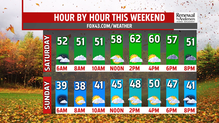


another shot of chilly air arrives. Temperatures climb to the upper 50s and lower 60s ahead of the next system. Bundle up for the evening because temperatures are going to tumble and the winds are going to increase. The weekend ends on a much chillier, gustier note. Morning lows drop to the upper 30s to near 40 degrees. Plenty of clouds and gusty winds out of the north-northwest, holds high temperatures in the upper 40s to near 50 degrees. Wind chill values will be much colder. A few sprinkles or flurries can’t be ruled out. Areas north and west of Harrisburg in the higher elevations have the best chance for seeing a few flakes.
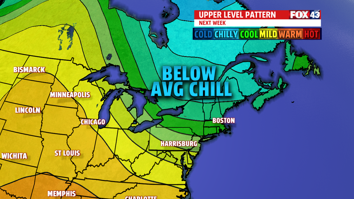
NEXT WEEK: Monday, high pressure calms the breeze down and clears the skies by morning. This leads to cold morning in the lower and middle 30s. Clouds mix with sunshine and it stays cooler than average in the lower 50s. The next disturbance quickly approaches keeping the chilly weather around Tuesday, however, temperatures recover to the upper 50s to near 60 degrees. The readings are knocked down a bit for Wednesday, but skies stay mostly sunny. Thursday is still cooler than average in the middle 50s but dry. The next chance for wet weather is Friday but not all the models agree on timing. We’ll keep you posted!
The FOX43 Weather Team is keeping you “Weather Smart” 7 days a week!
Have a good day!
MaryEllen Pann,
Chief Meteorologist