


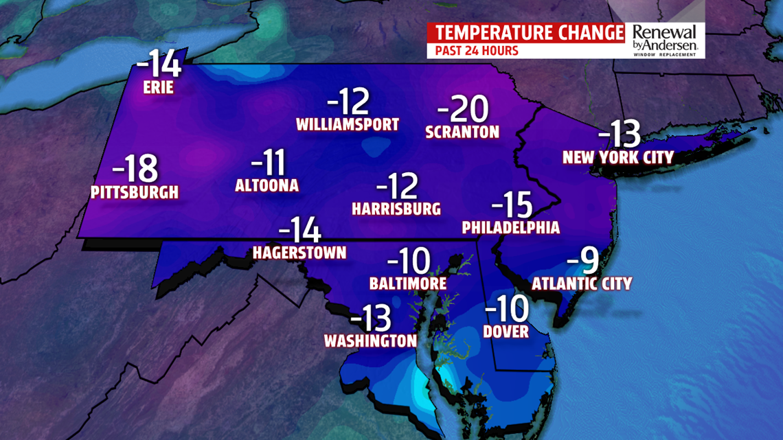
CHILLY AIR IN PLACE: Cooler than normal temperatures are the trend into much of the week ahead! The cold front that passed though on Sunday brings the latest chilled air mass. Winds are subsiding and will continue out of the west early Monday before shifting out of the south-southwest.

FROST ADVISORY: As winds settle down and temperatures drop down into the 30s overnight, many areas may see frost by Monday morning. York and Lancaster counties are under a Frost Advisory until 9:00 AM Monday.

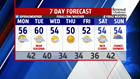
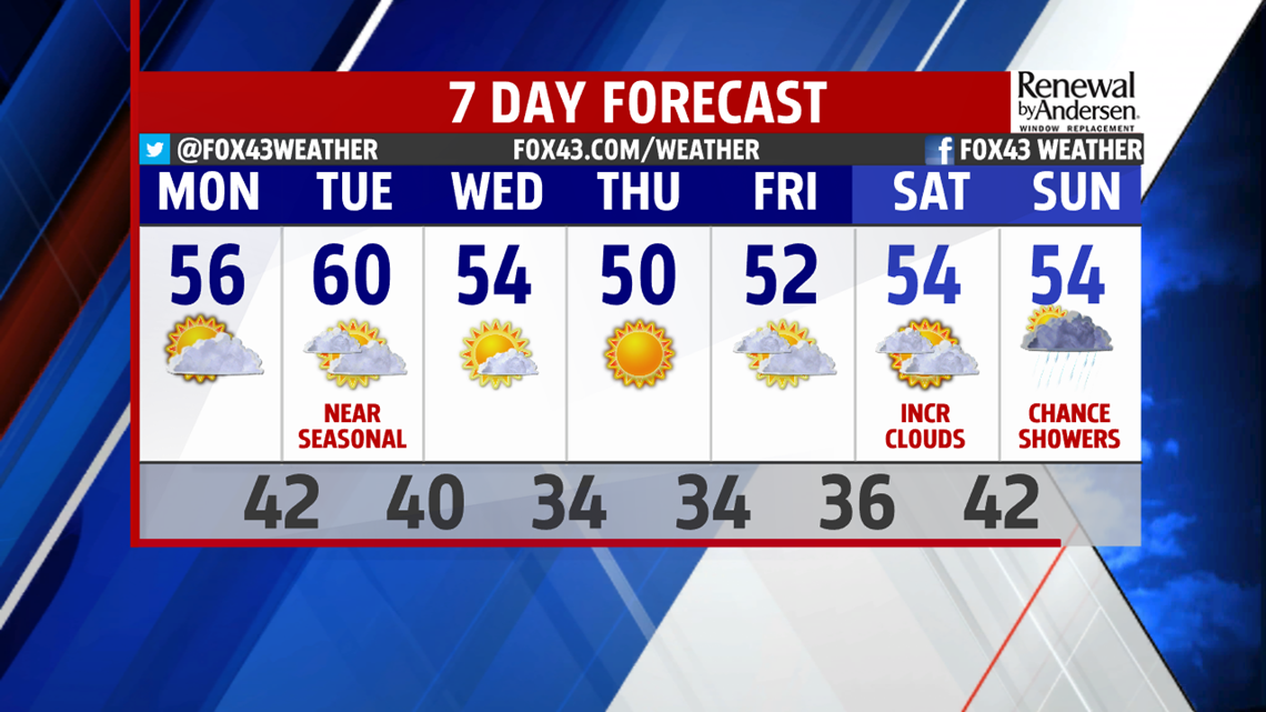
NEXT SIGNS OF RAIN?: Much of the week is looking on the dry side, with chilly overnight lows. There are neighborhood Trick-or-Treat nights scheduled this week, and the weather should be perfect for it – though a bit chilly – perhaps consider costumes with a few extra layers as temperatures drop quick after sunset. High pressure builds across our south on Monday and provides a return flow out of the south-southwest Monday afternoon, allowing temperatures to bump up a few degrees warmer. Monday’s high temperature will reach around 56 degrees. The warmest day of the week is likely Tuesday with a high in the upper 50s to near 60 degrees. Then, another cold front sweeps across the state for midweek – temperatures the rest of the week only get into the low-to-mid 50s, but with overnight lows in the mid-to-upper 30s! It isn’t until late Saturday and into Sunday that we see our next chance for rainfall as a storm develops across the Southeast and rides up the coast.
Have a great week!
Meteorologist Alan Petko
