
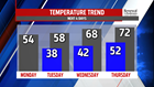


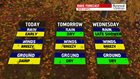


TURNING MILDER: Temperatures start to take a turn upwards through the middle of the week. It starts Tuesday, with a ridge of high pressure building into the region. There are some clouds to start Tuesday, enough to call it partly cloudy. However, you can expect more sunshine to build during the afternoon. Expect highs in the middle to upper 50s. The warming continues for Wednesday. Expect readings in the middle to upper 60s across the region! The trick-or-treat forecast could bring a light shower or two as the next system arrive, but most should be dry. More than likely, shower chances hold off until Thursday. It’s an even milder day, with temperatures pushing 70 degrees, and many spots could even be a little higher. Some late day showers are possible, but the brunt of the activity for most should wait until after sunset. Shower chances linger into Friday. It’s still mild, but not as mild as Thursday. Readings are back into the 60s.
WEEKEND OUTLOOK: The weekend is drier, but some small rain chances try to sneak into the area. We’re monitoring a small chance for a few showers at the moment on Saturday. Temperatures are cooler, with readings in the lower to middle 50s. Sunday is partly cloudy and dry. Expect temperatures in the middle to upper 50s.
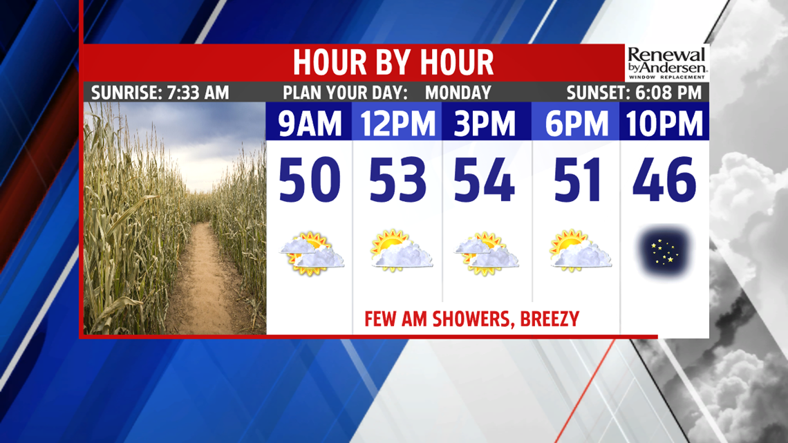
Have a great Monday!
