


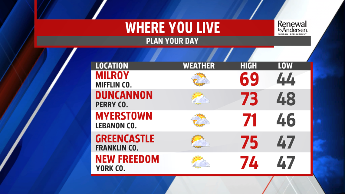
SEVENTIES FOR NOVEMBER: Our stalling rainmaker to the northwest brings another dose of warm air to Central PA for Thursday. Increasing cloud cover will be the trend, but we’ll see peeks of sunshine with a morning start in the 50s. Highs make it to the mid-70s with a very low chance of showers and a few rumbles of thunder in our northern counties. The bulk of the activity, however, will hold off until the overnight time frame.
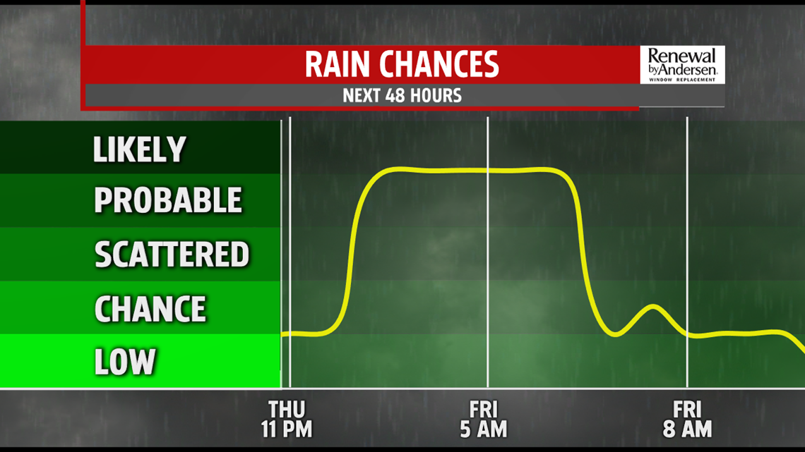
RAIN CHANCES FINISHING THE WEEK: As the cool front pushes through slowly, it will have multiple rounds of showers it tries to put out throughout Friday and into Saturday. These showers will not be consistent with very few locations remaining dry. Winds ramp up overnight into Friday and Saturday with gusts up to 30MPH possible. Rain totals around one-half inch in spots will be localized, but common. Another round of showers move through the area early Saturday morning before drying out for the rest of the weekend.
COOLER, THEN WARMER: After highs in the mid-to-upper 60s and falling throughout Friday, we stay in the 50s both Saturday and Sunday. A dry and crisp Sunday yields to warmer temperatures heading into next week. Highs jump back into the low-60s to start next week and continue to rise through the middle part of the week as well.
Have a great day!
-Meteorologist Bradon Long
