

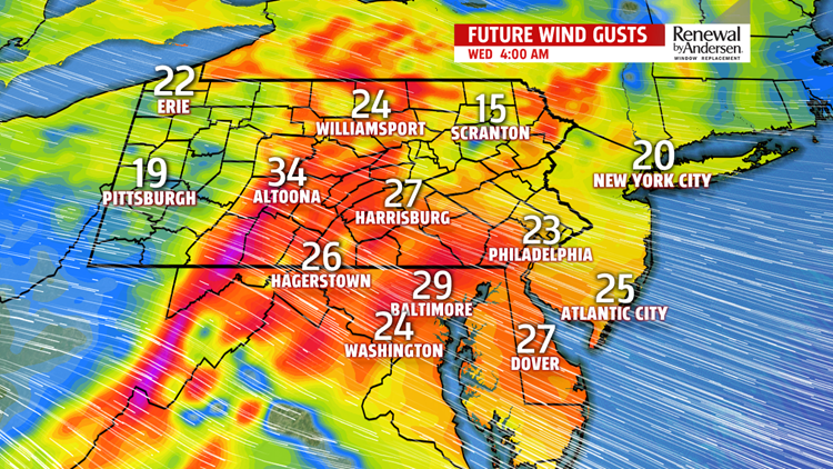
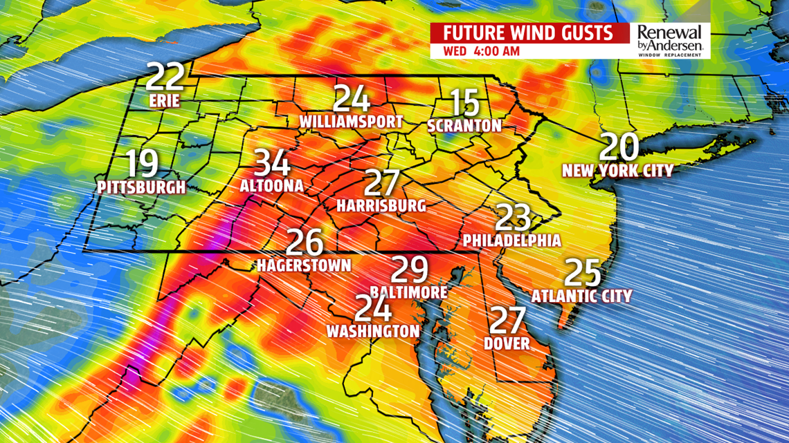


WINDY COUPLE OF DAYS: Wind gusts continue throughout the day at 20-30MPH for the most part under partly-to-mostly cloudy skies. As a result of the gusty west-northwesterly flow, temperatures don’t jump far. Afternoon temperatures only gain a couple of degrees, around the 40-degree mark. Wind chills stay in the low-30s. Wednesday is a near carbon copy, but a more northwesterly wind means the chance of snow squalls heads our way. Most of the activity should stay to our north and west, but we have a small chance. Keep that FOX43 Weather App handy!

SLOWLY WARMING: By Thursday, we stay dry and the winds calm down. This allows temperatures to jump into the mid-40s with mostly sunny skies. We would continue warming by Friday, but rain chances limit us to the low-to-mid 40s.
RAIN RETURNS: Consistent rain chances return Saturday with highs in the mid-40s. Another 0.5″ of rain is a good bet, more details to come as we get more data into the Weather Center. Mid-to-upper 50s return as a warm front lifts over the area for Sunday! But it comes crashing back down with more Sunday rain chances, allowing temperatures to cool back (though staying above average) by next Monday.
Have a great day!
-Meteorologist Bradon Long
